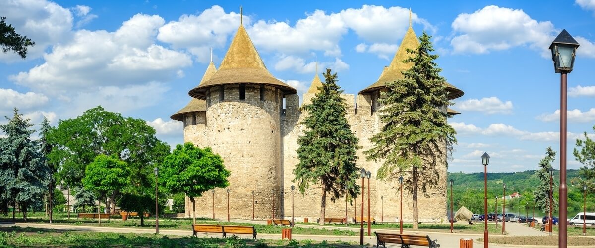
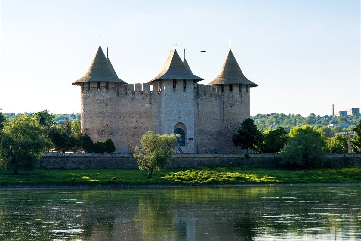

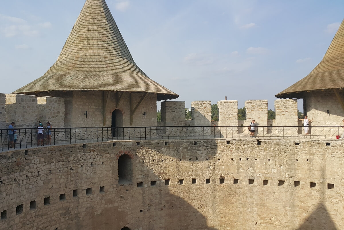
Soroca medieval fortress named the “pearl of fortification art” was built by the prince Stephen the Great in 1499. Between 1543 and 1546, the original wooden fort was rebuilt in stone by the prince Petru Rares. It was a unique historical monument of defensive constructions architecture composed of a huge tower holding five smaller towers surrounding it. Its architectural fortification system has a circular plane of 37.5 m in diameter, four circular towers and a rectangular access tower.
There is a legend about Soroca Fortress saying that during Stephen the Great’s reign, a large army of Tatars besieged the fortress for months. While waiting for help, the fighters in the fortress, in absence of food and water, were losing their strength and hope each day more. Soon some flocks of storks appeared unexpectedly, more
There is a legend about Soroca Fortress saying that during Stephen the Great’s reign, a large army of Tatars besieged the fortress for months. While waiting for help, the fighters in the fortress, in absence of food and water, were losing their strength and hope each day more. Soon some flocks of storks appeared unexpectedly, more
carrying bunches of grapes in their beaks, which they let drop inside the citadel. The grapes helped the soldiers get stronger and raised their spirits, and therefore they were able to heroically defeat the invaders. Since then, the stork is a symbol of unity, kindness and abundance.
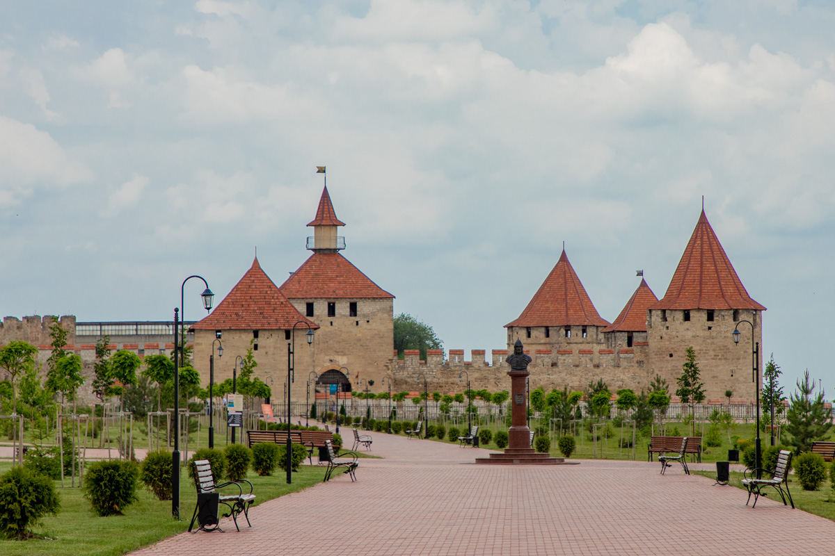
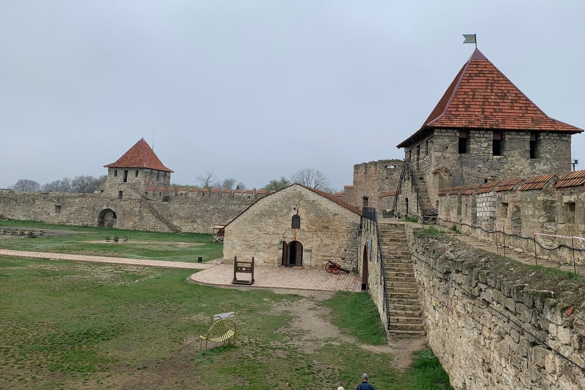
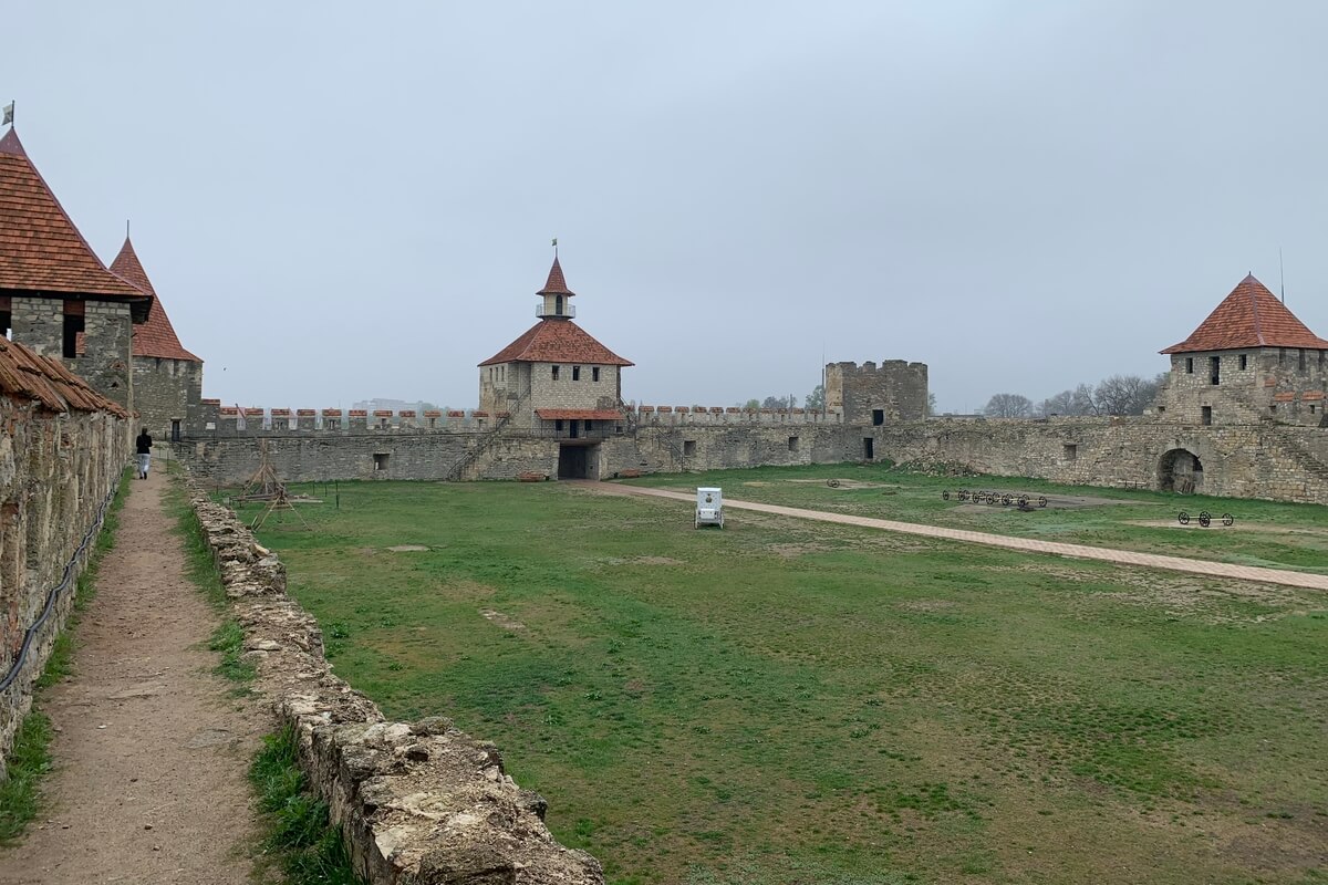
Tighina Fortress located in Tighina town was built in the 15th century by the prince of Moldova, Stephen the Great on the place of a former Genovese fortress. It was part of the defensive system of medieval Moldova, being one of the most powerful fortresses in the past. Originally built as a small wooden fort, it was later fortified in stone by the prince of Moldova, Petru Rares. Occupied by the Turks in 1538 (in a campaign lead by the sultan Suleiman the Magnificent), the fort was strengthened in 1541 and became the centre of an Ottoman “raya” (in which were included the surrounding Moldovan villages). It was renamed by the Turks in Bender, meaning a “fortified pass”. In the 18th century, the fort was strengthened by Moldovan craftsmen under the direct supervision of Dimitrie Cantemir. After the defeat in the Battle of Poltava (1709), more
the Swedish King Charles XII took refuge for several years in Bender. Tighina Fortress is an architectural ensemble of irregular quadrilateral plan, surrounded by wide walls, 2-3 meters thick, made of limestone and brick.
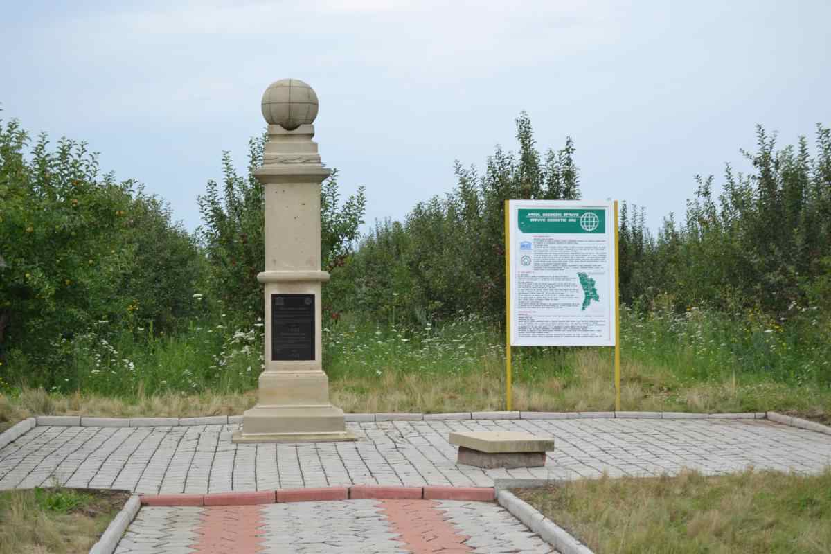
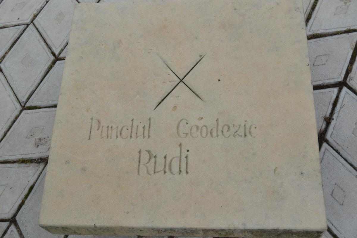
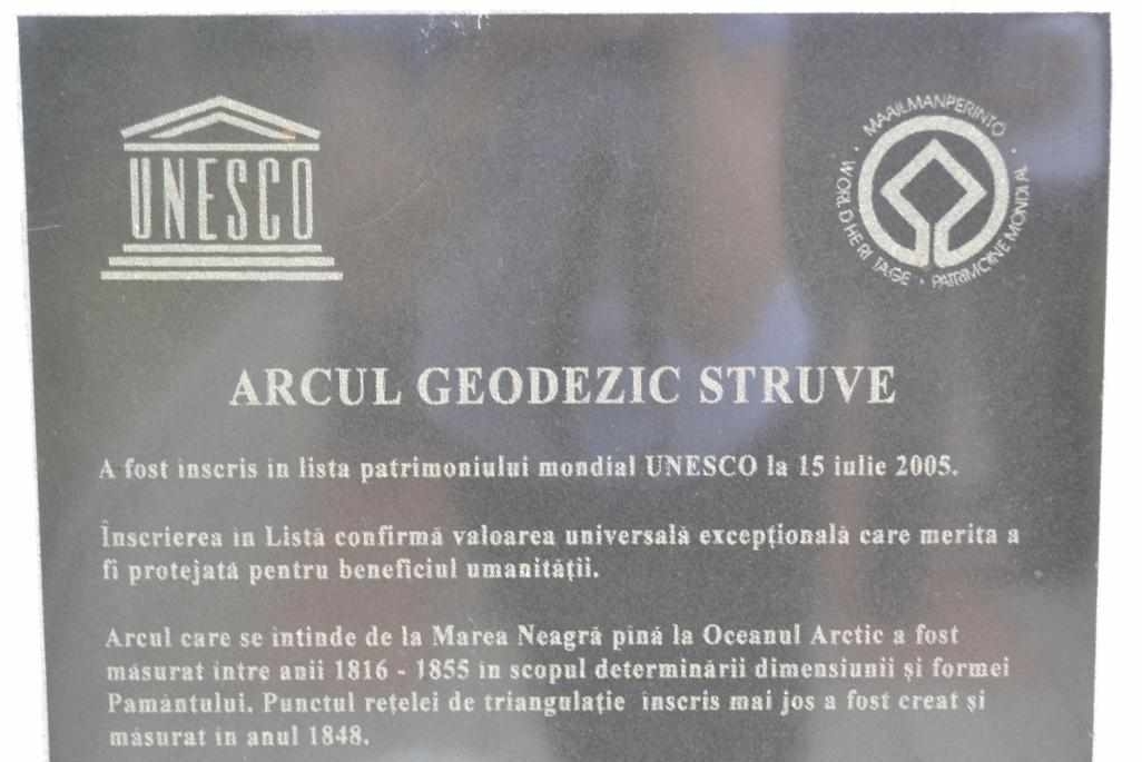
The Struve Geodetic Arc is a chain of survey triangulations stretching from Hammerfest in Norway to Old Nekrasovka in Ukraine, through 10 countries and over 2,820 km, resulting in a meridian’s first accurate measurement. The German-born Russian scientist Friedrich Georg Wilhelm von Struve established and used the chain in the years 1816 to 1855 to determine the exact size and shape of the earth. At that time, the chain only passed through two countries: the United Kingdoms of Sweden and Norway and the Russian Empire. On the territory of Moldova 27 such points have been established. Lt. Gen. Carl Tenner, who was the head of the measurements on the territory of Moldova (1846-1848), mostly carved marks on stones or pillars a bit into the surface. Therefore, the points could not be found easily. Rudi geodetic point of the Rudi Geodetic Arc was created and measured in 1848. more
It was identified on the ground in August 2003 at the initiative of UNESCO. The Struve Geodetic Arc near Rudi village is the only monument in the Republic of Moldova included in the UNESCO World Heritage List (July 2005).