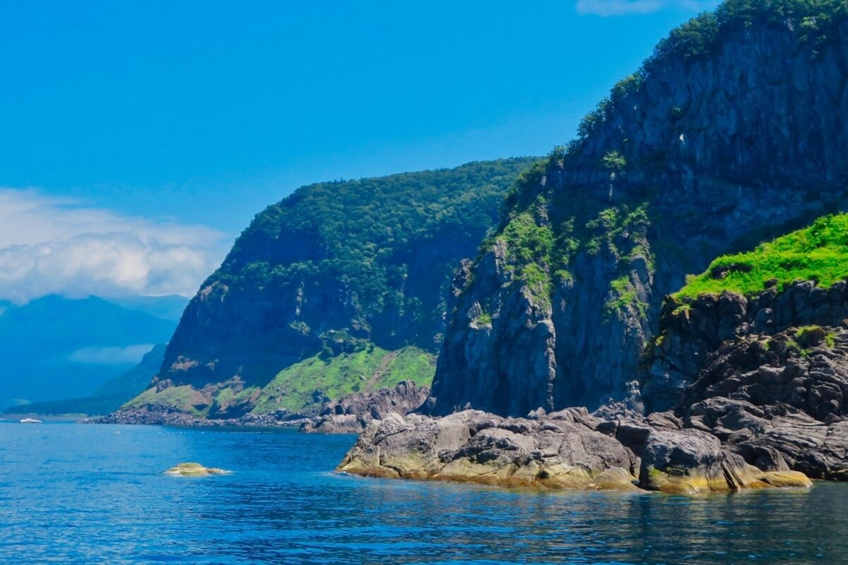

Located on the Shiretoko Peninsula in eastern Hokkaido, Shiretoko National Park is one of Japan’s most beautiful and unspoiled national parks. As one of the most remote regions in Japan, the northern tip of the peninsula is only accessible on foot during multi-day trekking tours or by boat – there are no roads that lead further than about three fourths up the peninsula. The Shiretoko Peninsula is 70 km long and 25 km wide at its centre and features a variety of natural environments including valleys, forests, rivers, mountain ranges, coasts, etc. The park has a hot spring waterfall called Kamuiwakka Falls. The spring water that pours out from Mount Io flows into a river and the waterfall basin is used as an open-air bath.
Shiretoko is best known as home to a variety of wildlife, including Japan’s largest brown bear population, more
Shiretoko is best known as home to a variety of wildlife, including Japan’s largest brown bear population, more
yezo deer and red foxes and for offering views of Kunashiri Island. As many as 600 species of animals inhabit the Shiretoko Peninsula, which is also a breeding area and wintering spot for endangered species such as Blakiston’s fish owl (the largest living species of owl) and white-tailed sea eagle. In winter, the coast of the peninsula along the Sea of Okhotsk becomes one of the northern hemisphere’s southernmost regions to see drift ice. Seals come to Shiretoko when drift ice comes ashore. Some of them settle in adjacent waters.
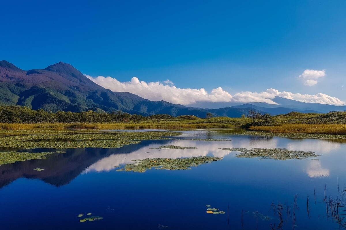
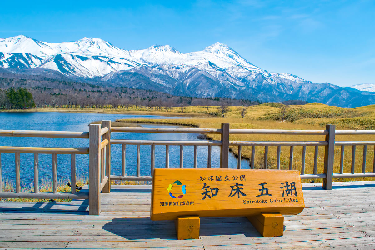
The forests of the park are temperate and subalpine mixed forests including tree species such as Sakhalin fir, Erman’s birch and Mongolian oak. Beyond the forest limit, impenetrable Siberian dwarf pine (Pinus pumila) thickets grow. In the middle of a primeval forest, Shiretoko Five Lakes are dotted. You can see an abundance of the great nature with brown bear tracks and black woodpecker bites. There are very attractive trekking and walking courses including Shiretoko Five Lakes, the surrounding primeval forests, Lake Raussu, alpine belts, etc. The programs in the forests are offered by Shiretoko National Park Nature Centre in Shari that serves as a visitor centre.
In 2005, Shiretoko was included in the UNESCO’s List of World Heritage Sites for the irreplaceable value of the peninsula’s ecosystem and biodiversity.
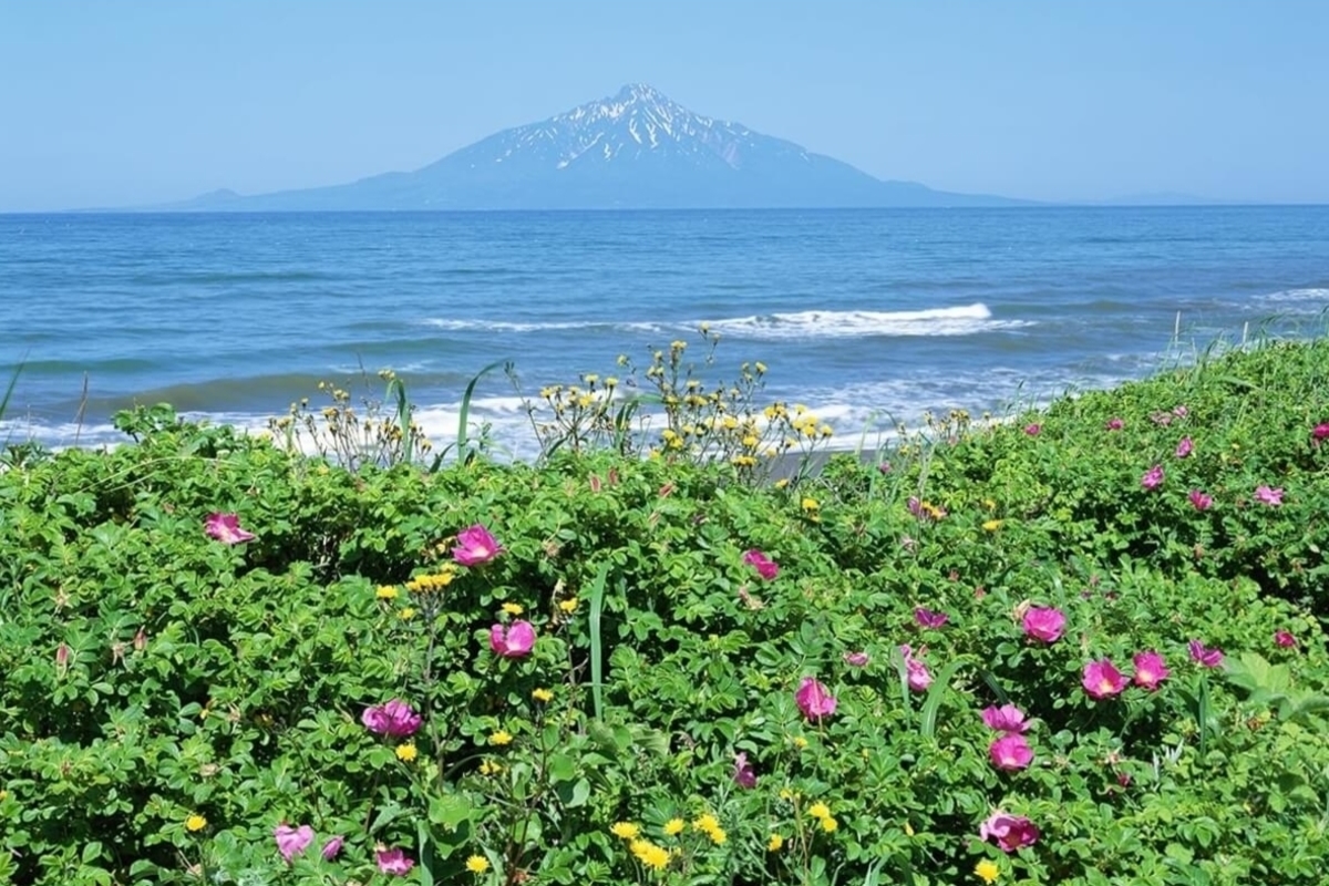
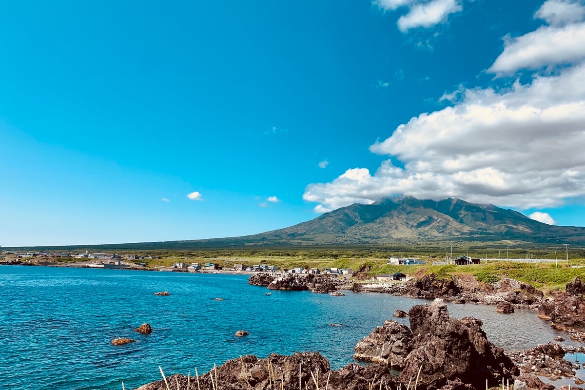
Rishiri-Rebun-Sarobetsu National Park is the northernmost National Park in Japan including two small islands near the northern tip of Hokkaido: Rishiri Island and Rebun Island. The islands offer beautiful hiking trails, coastal sceneries, alpine flowers and small fishing villages.
Rishiri is a round island with the 1721 m tall Mount Rishiri at its centre that soars majestically above the sea. Due to its appearance and the fact that its cone shape resembles Mount Fuji, the dormant volcano is also known as Rishiri-Fuji. Otadomari Marsh is one of the main sightseeing spots on Rishiri Island blessed with awesome natural beauty.
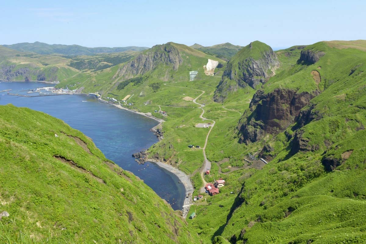
Rebun is longer and flatter than Rishiri and has many alpine flowers. A hilly topography surrounds the island’s highest peak, more
Rishiri is a round island with the 1721 m tall Mount Rishiri at its centre that soars majestically above the sea. Due to its appearance and the fact that its cone shape resembles Mount Fuji, the dormant volcano is also known as Rishiri-Fuji. Otadomari Marsh is one of the main sightseeing spots on Rishiri Island blessed with awesome natural beauty.
Rebun is longer and flatter than Rishiri and has many alpine flowers. A hilly topography surrounds the island’s highest peak, more
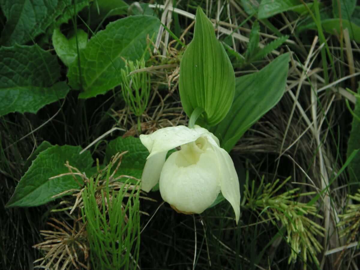
Mt. Rebun-dake (490 metres above sea level). Strange and bizarre rock formations are seen on the west side of the island. Rebun is famous as a floral island with more than 300 different species of naturally growing alpine plants. On the island, you can see such rare alpine flowers as rebun-atsumoriso (lady’s slipper), that blooms around the middle of June, rebun-usuyukiso (season: early June to mid-August), rebun-hanashinobu (season: early to late June). The flower garden around Momoiwa Scenic Overlook has been designated as a natural monument of Hokkaido. Rebun Island has a number of walking and hiking trails, including Momo-iwa hiking course and the Mt. Rebun-dake climbing trail.
Sarobetsu Plain is abundant in marsh plants and Wakasakanai’s dunes. Its land area measures approximately 20,000 hectares. While visitors cannot freely walk about inside the Sarobetsu Moor, portions of it can be explored by tracing the wooden walking trails that have been built throughout different parts of this environment. Wooden walking trails for exploring wetlands have been installed in the upper end of the Sarobetsu Plain in Toyotomi town, the lower end of the Sarobetsu Plain in Horonobe town, and elsewhere. Heathberry plants blossom to mark the spring; Sanguisorba tenuifolia var. alba plants flower bloom until the end of September; and cotton grass, bog rosemary, Amur daylily, and many more varieties of flowering plants grow and blossom in different seasons. You will definitely enjoy this beautiful landscape of myriad small flowers flourishing in the vast plain.
Sarobetsu Plain is abundant in marsh plants and Wakasakanai’s dunes. Its land area measures approximately 20,000 hectares. While visitors cannot freely walk about inside the Sarobetsu Moor, portions of it can be explored by tracing the wooden walking trails that have been built throughout different parts of this environment. Wooden walking trails for exploring wetlands have been installed in the upper end of the Sarobetsu Plain in Toyotomi town, the lower end of the Sarobetsu Plain in Horonobe town, and elsewhere. Heathberry plants blossom to mark the spring; Sanguisorba tenuifolia var. alba plants flower bloom until the end of September; and cotton grass, bog rosemary, Amur daylily, and many more varieties of flowering plants grow and blossom in different seasons. You will definitely enjoy this beautiful landscape of myriad small flowers flourishing in the vast plain.
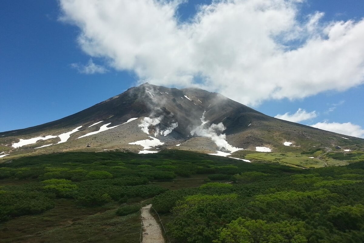
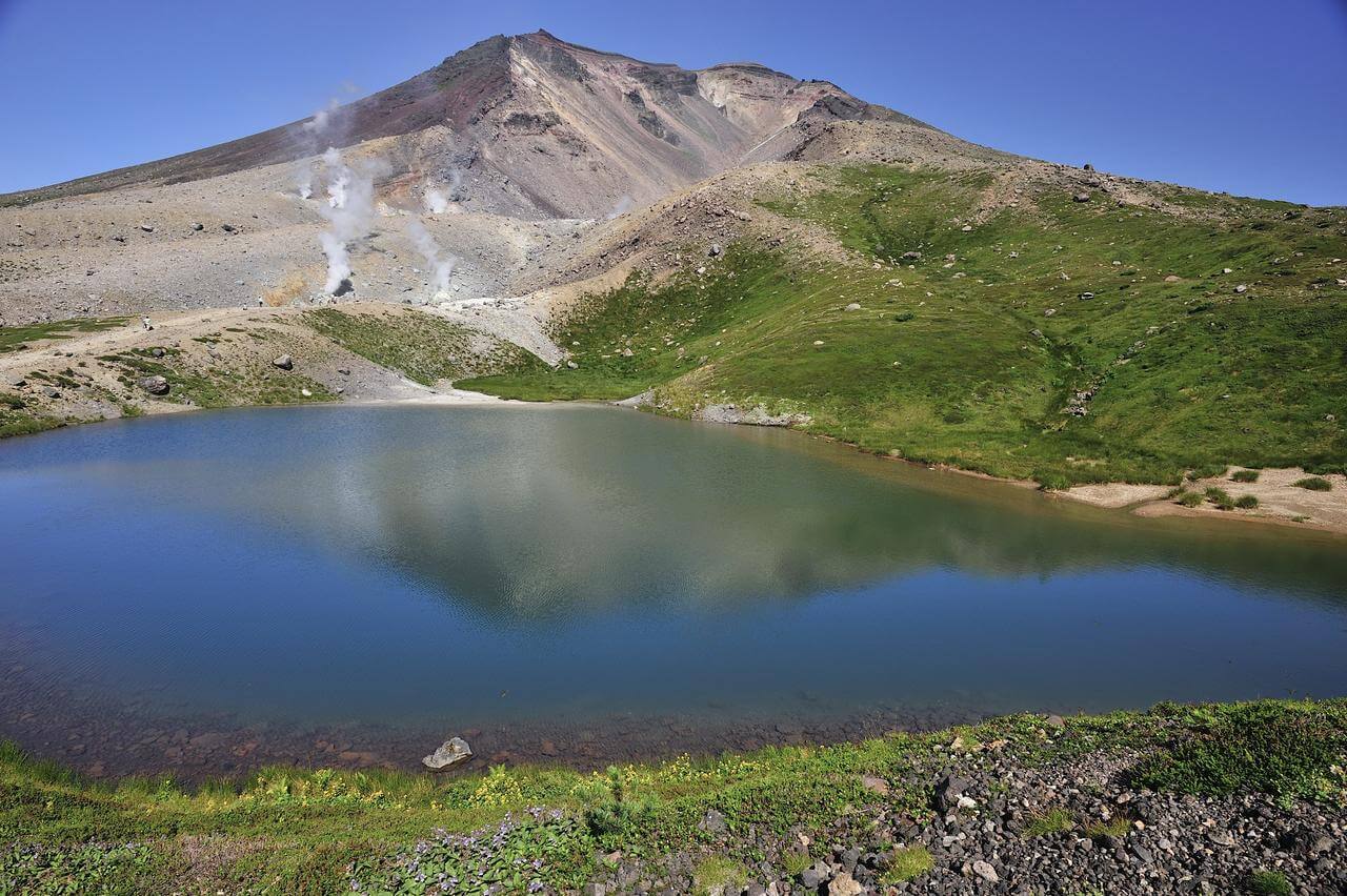
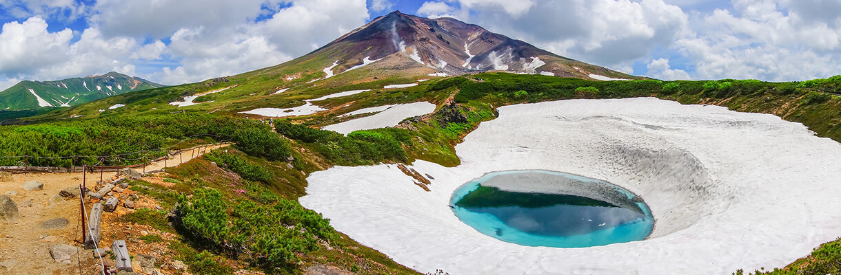
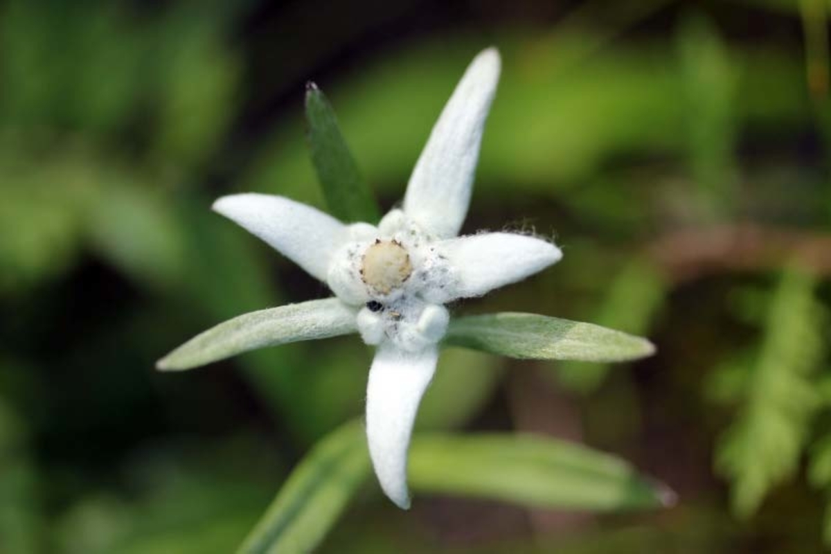
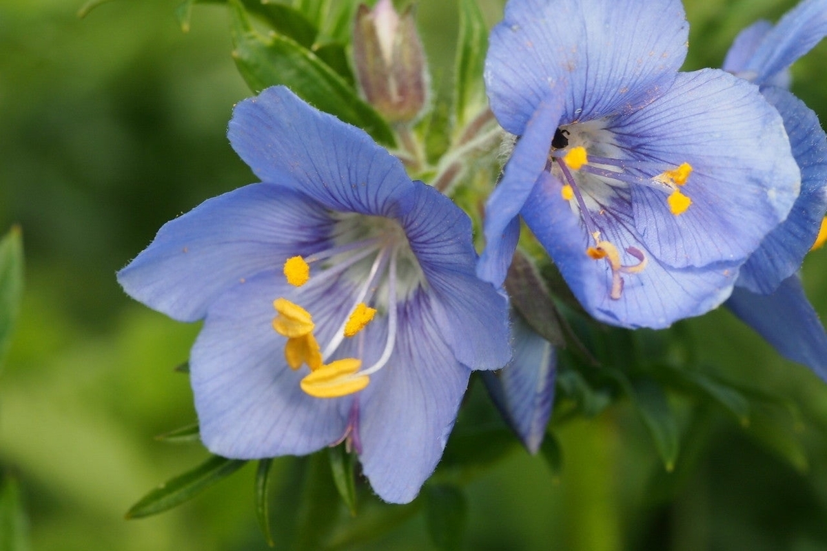
Daisetsuzan National Park is the largest national park in Japan (2,300 km2) and includes Mount Asahi-dake (2,290 m), the highest mountain in Hokkaido. Alpine plants can be seen from mid-June through late August. The snow remaining even in summer, the Japanese stone pines and the alpine plants make a beautiful scenery. Daisetsuzan means “great snowy mountains” and comprises 16 peaks over 2,000 m, both with and without trails.
Daisetsuzan National Park is famous for its wildlife and several rare species can be found here. The park is home to the brown bear and the pika, a small mammal, with short limbs, rounded ears, and no external tail. The forests of Daisetsuzan National Park are dominated by trees such as the Picea jezoensis, the Jezo spruce, and the Abies sachalinensis, more
Daisetsuzan National Park is famous for its wildlife and several rare species can be found here. The park is home to the brown bear and the pika, a small mammal, with short limbs, rounded ears, and no external tail. The forests of Daisetsuzan National Park are dominated by trees such as the Picea jezoensis, the Jezo spruce, and the Abies sachalinensis, more
the Sakhalin fir. Half of alpine plants found in Hokkaido totalling around 225 species grow in Daisetsuzan National Park. It is a paradise for hikers, outdoor lovers, deer and brown bears, and the first place in Japan to see fall colours and snow each autumn.
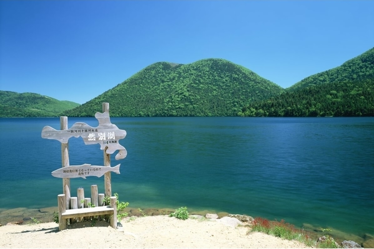
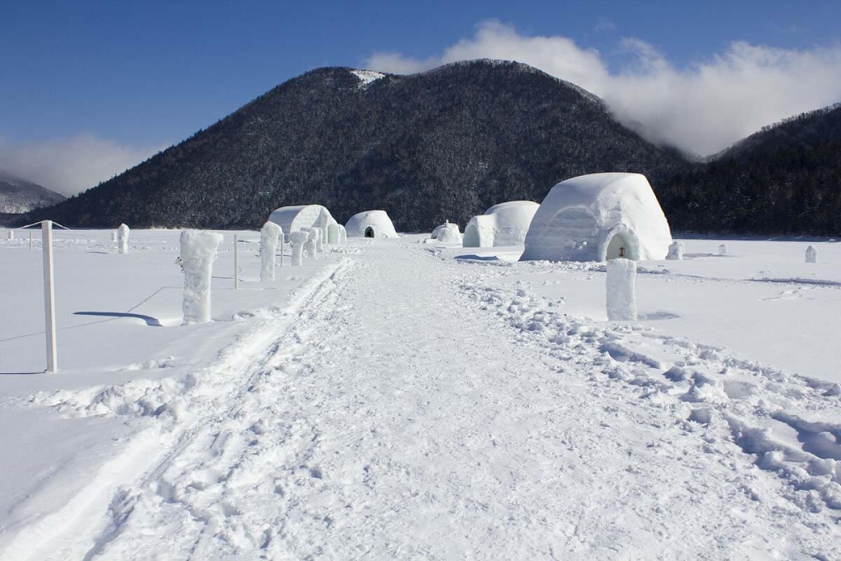
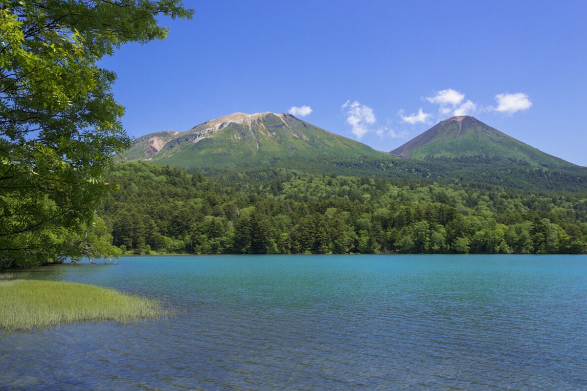
On the southeastern edge of the Daisetsuzan National Park, sits Lake Shikaribetsu, a freshwater lake located about 40 km north of Obihiro city. It’s the highest lake in Hokkaido, being located at about 800 m. It is about 4 km long from north to south and 1 to 2 km wide being surrounded by mountains reaching 1,000 m. The lake is within the Daisetsuzan National Park and besides a hot spring resort with two hotels at the southwestern side of the lake, no other private homes are around it. In front of the lake, you can admire a beautiful upper lip shaped mountain named Tenbou Mountain, called by locals Kuchibiru-yama (“Mount Lips”). It has an elevation of 1,173 m and a prominence of 208 m in the Ishikari Mountains. The visitors of the lake can enjoy outdoor activities in summer such as canoeing and admire the beautiful coloured leaves in autumn. From December to May, this lake freezes over, and from January to March, the village of igloos (houses made of ice blocks) “Shikaribetsu kotan” is opened on the frozen lake.
On the southeastern edge of the Daisetsuzan National Park, sits Lake Shikaribetsu, a freshwater lake located about 40 km north of Obihiro city. It’s the highest lake in Hokkaido, being located at about 800 m. It is about 4 km long from north to south and 1 to 2 km wide being surrounded by mountains reaching 1,000 m. The lake is within the Daisetsuzan National Park and besides a hot spring resort with two hotels at the southwestern side of the lake, no other private homes are around it. In front of the lake, you can admire a beautiful upper lip shaped mountain named Tenbou Mountain, called by locals Kuchibiru-yama (“Mount Lips”). It has an elevation of 1,173 m and a prominence of 208 m in the Ishikari Mountains. The visitors of the lake can enjoy outdoor activities in summer such as canoeing and admire the beautiful coloured leaves in autumn. From December to May, this lake freezes over, and from January to March, the village of igloos (houses made of ice blocks) “Shikaribetsu kotan” is opened on the frozen lake.
Akan Mashu National Park is located in eastern Hokkaido and includes volcanoes, forests and three beautiful lakes: Lake Akan, Lake Mashu and Lake Kussharo. Akan Mashu National Park comprises two separate parts. The smaller, western portion is composed of Lake Akan with the lakeside hot spring resort of Akankohan Onsen, while the larger, eastern part comprises Lake Mashu, Lake Kussharo, Iozan (Sulphur Mountain) and centrally located Kawayu Onsen.
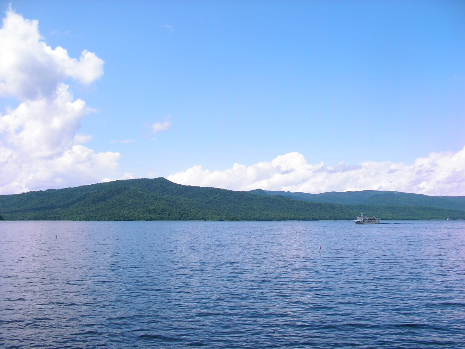
Lake Akan is a beautiful crater lake formed around 6,000 years ago by volcanic activity. The area of the lake is 12.92 km2. This caldera lake (altitude 420 m) is 26 km in circumference and 44.8 m deep. It has four islets: Oshima, Kojima, Yaitai and Churui.
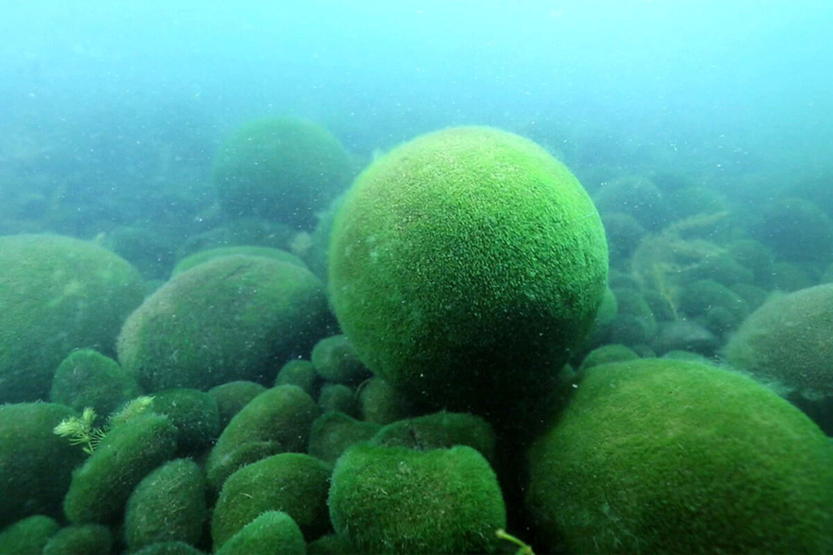
It is home to a cute natural spherical wonder - marimo, more
Lake Akan is a beautiful crater lake formed around 6,000 years ago by volcanic activity. The area of the lake is 12.92 km2. This caldera lake (altitude 420 m) is 26 km in circumference and 44.8 m deep. It has four islets: Oshima, Kojima, Yaitai and Churui.
It is home to a cute natural spherical wonder - marimo, more
a rare species of green alga that forms itself into beautiful balls. Marimo in Lake Akan were first discovered in 1897 and named marimo because of their spherical shape. In 1951 they were designated a National Special Natural Monument by the government with the purpose of preserving the species. Left alone for a few centuries, Lake Akan’s marimo grow particularly large, up to 20 - 30 cm. Marimo are distributed mainly in high-latitude areas of the northern hemisphere and have been confirmed inhabiting more than 10 lakes in Honshu and Hokkaido. However, Lake Akan is the only place in Japan where spherical marimo inhabit in communities. So, how do marimo become spherical? The gentle wave action maintains the round shape of the marimo and occasionally turns it. When a large spherical marimo is broken by waves, it falls into many wedge-shaped pieces that grow into small oval aggregations. As they increase in size, marimo is moved to deeper places offshore by the water current. When they go deeper, parts of the algae wither because sunlight does not fully reach the lake bottom and gradually their shapes break down.
If you visit the lake, you can take advantage of the lakeside hot spring resort of Akankohan dating back to 1908. It has grown into a charming town, the only town around the lake. There are more than 30 hotels and ryokans (Japanese-style inns) in the town, some of which have hot spring baths with views of the lake on their upper floors. Sightseeing boats leave Akankohan for 1-hour cruises of the lake, which include a stop at the Marimo Exhibition and Observation Centre located on Churui Island in the northern reaches of Lake Akan where you can observe the legendary marimo.
You should also visit Ainu Kotan, a small Ainu village in Akankohan that stands out for its street lined by souvenir shops specializing in traditional Ainu handicrafts. There is a small museum at the end of the street where traditional Ainu crafts, clothes and daily life utensils are displayed. This largest kotan has a population of about 200 people. Unique Ainu traditional dances designated an important Intangible Folk-Cultural Property are performed at the chise (house) in the heart of the kotan. The chise here accommodates about 400 people making it the largest in Hokkaido.
Two mountains near Lake Akan compliment the scenery: Oakan (Male Mountain) and Meakan (Female Mountain). They are both volcanoes whose eruptions formed the landscape around Lake Akan and they are very popular attractions of the Akan district. Mount Oakan is a dormant volcano with beautiful scenery that stands at an altitude of 1,371 m. At the top of the mountain, you will find a flower garden dedicated to alpine flora. Mount Meakan remains active and frequently emits sulphuric fumes. It consists of a number of volcanoes that erupted repeatedly, blocking the outflow of water. As a result, Lake Onneto, a dammed lake formed at the western foot of the mountain. The two mountains are surrounded by virgin forests, including trees such as virgin silver fir and abies. Hikers should check beforehand the volcano conditions at the tourist information centre.
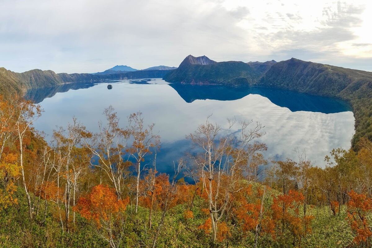
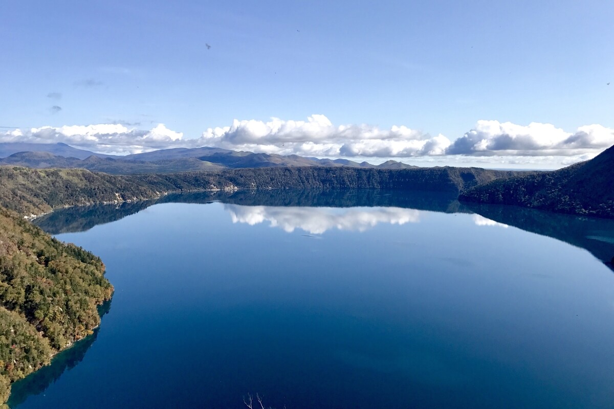
Lake Mashu is one of the most transparent lakes in the world and one of the country’s deepest lakes. Although it is usually appreciated for its clear water, in summer, the surface of the lake is often obscured by fog. Lake Mashu is a crater lake formed about 32,000 years ago in the caldera of a potentially active volcano and steep crater walls 200 m high surround it. The eruption that created the current caldera occurred around 7,000 years ago, while the last eruption was a plinian eruption that happened about 2,000 years ago and dropped pumice over the region. Visitors are prohibited to go down to the lake, however there are two observation decks around the rim of the caldera from where they can enjoy views.
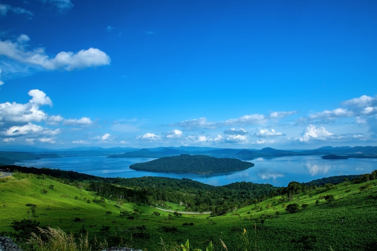
Lake Kussharo is a beautiful caldera lake located in Akan Mashu National Park. With a circumference of 57 km, it is the park’s largest lake. Different outdoor activities, such as fishing, hiking, kayaking and cycling, can be enjoyed around the lake. Also, there are several outdoor hot spring baths (rotenburo) located along the lake’s shores that can be used for free and, unlike most other hot spring baths in Japan, in swim suits.
If you visit the lake, you can take advantage of the lakeside hot spring resort of Akankohan dating back to 1908. It has grown into a charming town, the only town around the lake. There are more than 30 hotels and ryokans (Japanese-style inns) in the town, some of which have hot spring baths with views of the lake on their upper floors. Sightseeing boats leave Akankohan for 1-hour cruises of the lake, which include a stop at the Marimo Exhibition and Observation Centre located on Churui Island in the northern reaches of Lake Akan where you can observe the legendary marimo.
You should also visit Ainu Kotan, a small Ainu village in Akankohan that stands out for its street lined by souvenir shops specializing in traditional Ainu handicrafts. There is a small museum at the end of the street where traditional Ainu crafts, clothes and daily life utensils are displayed. This largest kotan has a population of about 200 people. Unique Ainu traditional dances designated an important Intangible Folk-Cultural Property are performed at the chise (house) in the heart of the kotan. The chise here accommodates about 400 people making it the largest in Hokkaido.
Two mountains near Lake Akan compliment the scenery: Oakan (Male Mountain) and Meakan (Female Mountain). They are both volcanoes whose eruptions formed the landscape around Lake Akan and they are very popular attractions of the Akan district. Mount Oakan is a dormant volcano with beautiful scenery that stands at an altitude of 1,371 m. At the top of the mountain, you will find a flower garden dedicated to alpine flora. Mount Meakan remains active and frequently emits sulphuric fumes. It consists of a number of volcanoes that erupted repeatedly, blocking the outflow of water. As a result, Lake Onneto, a dammed lake formed at the western foot of the mountain. The two mountains are surrounded by virgin forests, including trees such as virgin silver fir and abies. Hikers should check beforehand the volcano conditions at the tourist information centre.
Lake Mashu is one of the most transparent lakes in the world and one of the country’s deepest lakes. Although it is usually appreciated for its clear water, in summer, the surface of the lake is often obscured by fog. Lake Mashu is a crater lake formed about 32,000 years ago in the caldera of a potentially active volcano and steep crater walls 200 m high surround it. The eruption that created the current caldera occurred around 7,000 years ago, while the last eruption was a plinian eruption that happened about 2,000 years ago and dropped pumice over the region. Visitors are prohibited to go down to the lake, however there are two observation decks around the rim of the caldera from where they can enjoy views.
Lake Kussharo is a beautiful caldera lake located in Akan Mashu National Park. With a circumference of 57 km, it is the park’s largest lake. Different outdoor activities, such as fishing, hiking, kayaking and cycling, can be enjoyed around the lake. Also, there are several outdoor hot spring baths (rotenburo) located along the lake’s shores that can be used for free and, unlike most other hot spring baths in Japan, in swim suits.


In Eastern Hokkaido there are many wetlands that are registered under the Ramsar Convention. In order to preserve the country’s largest wetland and marsh habitat that supports the only known population of endangered Japanese cranes (red-crowned cranes) in Japan, Kushiro Marsh (Kushiro Shitsugen) in Hokkaido was designated as a national park in 1987. The park is located between Kushiro city and Akan National Park and covers an area of approximatively 26,861 ha.
An important attraction of the park is the Kushiro Marsh, the largest marsh in Japan with an area of about 200 km. The park is highly appreciated as a habitat of valuable plants, wild animals and birds including Japanese cranes that are resident birds in Eastern Hokkaido throughout the year. About 600 kinds of plants and flowers, more
An important attraction of the park is the Kushiro Marsh, the largest marsh in Japan with an area of about 200 km. The park is highly appreciated as a habitat of valuable plants, wild animals and birds including Japanese cranes that are resident birds in Eastern Hokkaido throughout the year. About 600 kinds of plants and flowers, more
26 kinds of mammals, 4 kinds of amphibians, 5 kinds of reptiles, about 170 kinds of birds and 35 kinds of fish can be found at the marsh. Japanese cranes can be viewed in the park all year round, but the best season for viewing these birds is winter when they return to their feeding grounds. Even in winter, the park does not receive much snowfall, and such activities as bird watching, nature viewing, and walking trails can be enjoyed.

Shikotsu-Toya National Park (600 km2) is located in southwestern Hokkaido and was named after its two famous lakes, Toya and Shikotsu. Its proximity to Sapporo makes it a popular destination for travellers with limited time in Hokkaido. Its spectacular scenery includes caldera lakes, onsen towns and volcanic mountains offering visitors a range of outdoor activities from hiking to hot springs.
The park is divided into five parts, each of them featuring various attractions. The most famous two park areas are of course Toya and Shikotsu. Both lakes are caldera lakes that were formed from collapses in the earth after volcanic activity. The onsen towns of Noboribetsu and Jozankei are also very popular. The fifth distinct park area is Mount Yotei, a perfectly shaped volcano near Niseko.
Lake Shikotsu, more
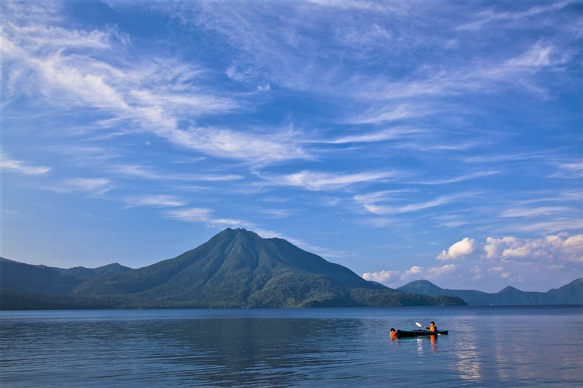
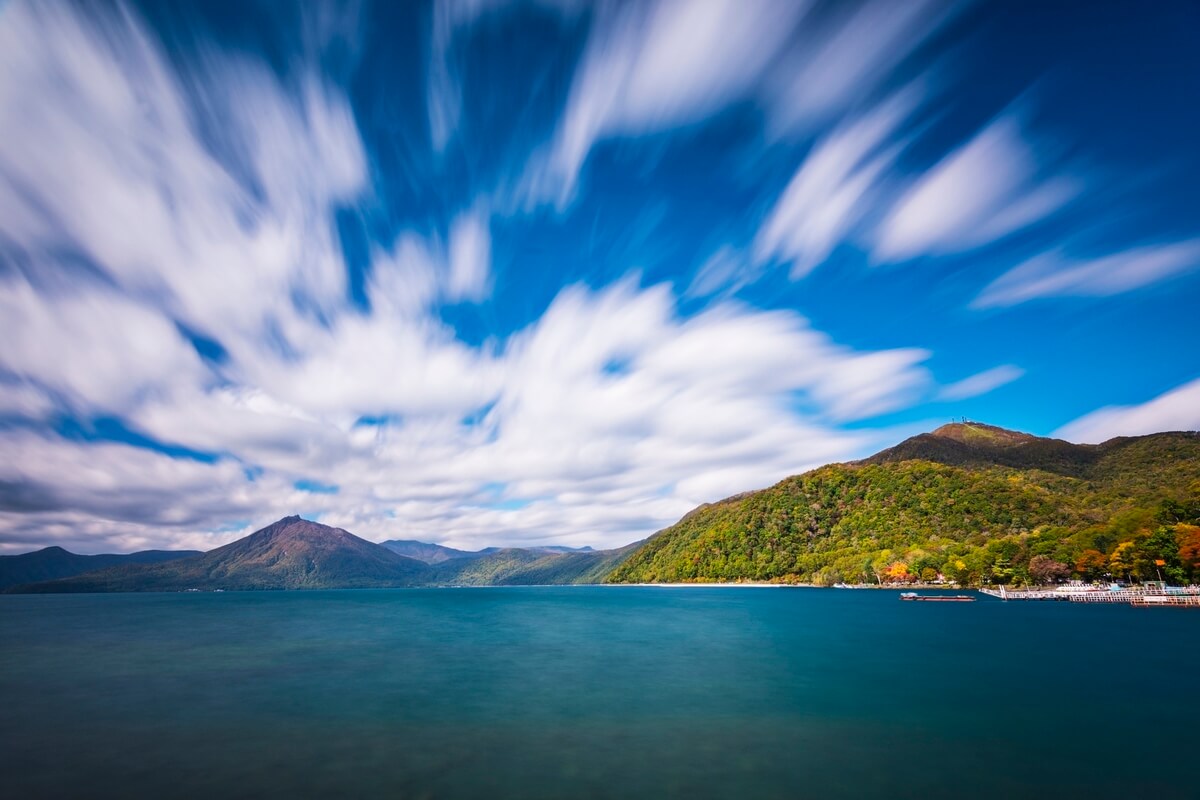
the second-deepest lake in Japan, has a depth of 265 metres, and is encircled by three mountains: Mount Eniwa, Mount Fuppushi, and Mount Tarumae. These mountains offer great hiking trails, with incredible views over the park and you can choose between sleeping under the stars, as the area has many campsites or staying at a luxury ryokan such as Shikotsuko Daiichi Hotel Suizantei or Marukoma Hot Spring Hotel. The second one is a ryokan with unique hot spring baths located right along the lakeshore and connected to the lake by small canals.
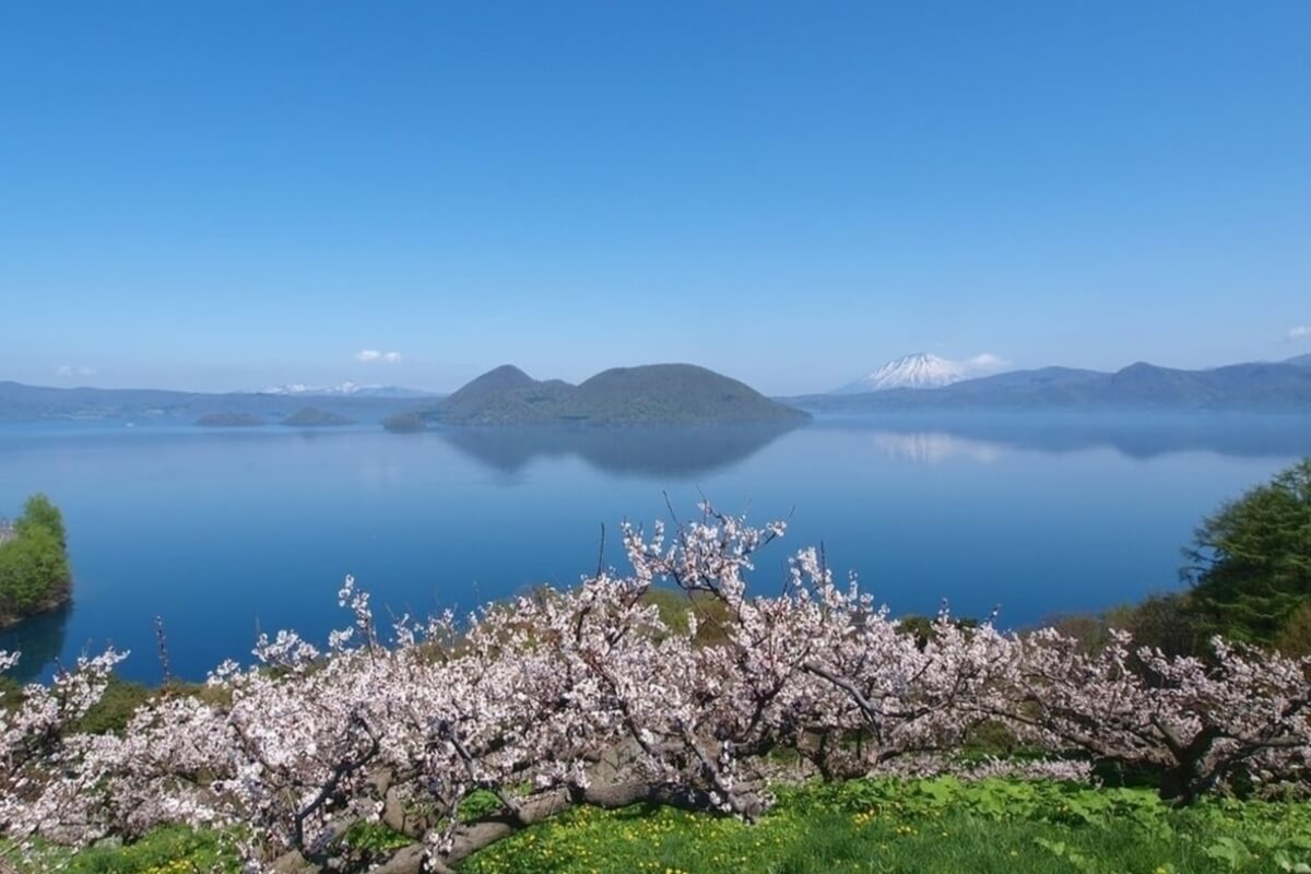
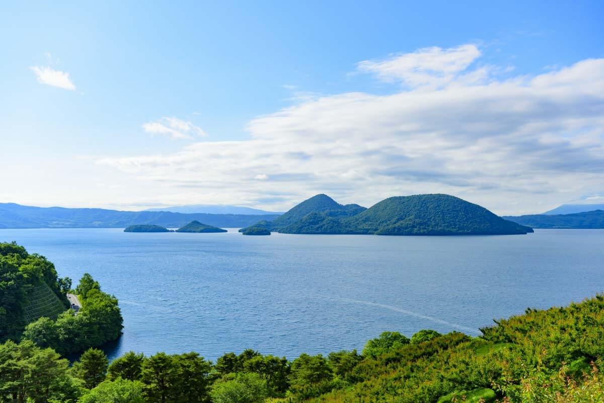
Lake Toya is a photogenic caldera lake with an island smack dab in the centre. Toya’s surrounding area offers excellent hiking, mainly on the active volcano Mount Usu, which last erupted in March 2000 - September 2001. There is also a ropeway up the mountain, giving everyone the chance to admire the spectacular views. The crater can be seen from the Usu Crater Basin Observatory located on the summit.
Lake Toya is a photogenic caldera lake with an island smack dab in the centre. Toya’s surrounding area offers excellent hiking, mainly on the active volcano Mount Usu, which last erupted in March 2000 - September 2001. There is also a ropeway up the mountain, giving everyone the chance to admire the spectacular views. The crater can be seen from the Usu Crater Basin Observatory located on the summit.