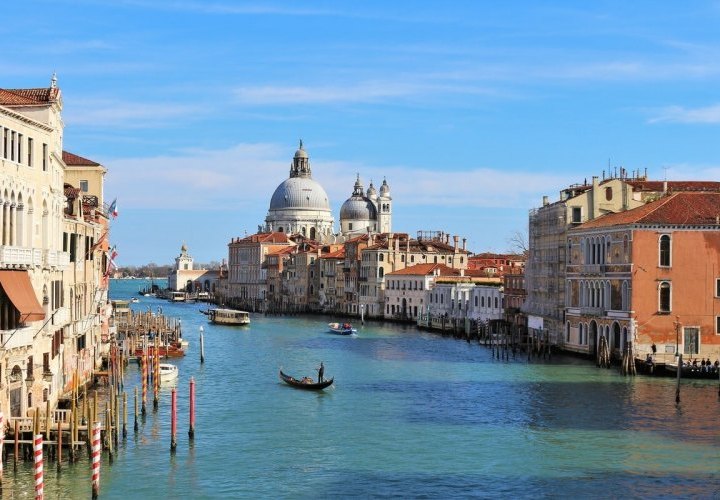
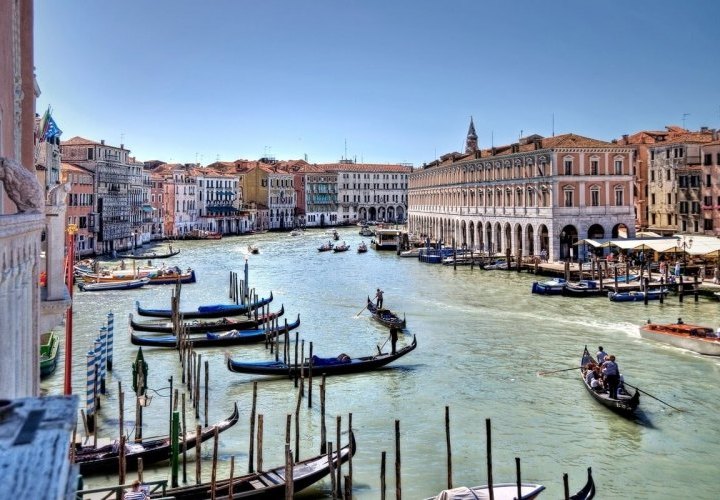
There is no other city like the spectacular floating city of Venice, which has 180 canals, 450 bridges and many historical landmarks of huge artistic and cultural importance. Everyone should sail down the Grand Canal of Venice (main artery and primary waterway) at least once in their life. The Grand Canal is 3.8 km long and between 30 and 90 metres wide and follows an inverted-S course from San Marco Basilica to Santa Chiara Church, dividing Venice into two parts. With an average depth of 5 metres, the canal is plied by hundreds of gondolas, ferries, traghetti, speedboats, and small commercial crafts each day. It is spanned by 4 bridges, the oldest one being the Rialto Bridge (Ponte di Rialto), and is lined with many spectacular buildings and Venetian palaces (palazzi), from early Byzantine-Romanesque to Renaissance palaces and neoclassical temple-like mansions. more
The canal connects at various points with a maze of smaller canals which are quieter, but these are less picturesque at night, so they are a good choice for a daylight ride.
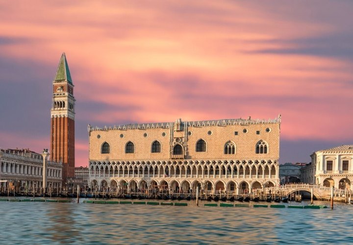
On the contrary, when the sun comes down and the lights from the Grand Canal palaces and canal-side restaurants reflect and glimmer on the water, it may be the most romantic time of all for drifting along the Grand Canal in a graceful gondola. Actually, riding a gondola along the Grand Canal is by far one of the top things to do in Italy. In the evening, when the lights come on, you can enjoy an amazing gondola experience, but at this time, the Grand Canal is also busy with other boats. However, the choice of the time of the day and route depend on your personal preferences. You can find a gondolier (the person who propels a gondola using a rowing oar) in a striped shirt and straw hat along the Grand Canal by the Doge’s Palace and at Rialto Bridge, and you will see many of them on bridges and canals as you explore the city.
If you don’t want to book an expensive gondola ride, you can enjoy a 58-minute excursion in the slow boat, the Line 1 vaporetto (Venice’s most popular waterbus), which starts off from Piazzale Roma and follows a zigzag path up the Grand Canal, to end up in Lido, and vice versa. You can wait until dusk descends, grab a Line 1 vaporetto at the first stop (Piazzale Roma), and ride it to the end of the Grand Canal at San Marco Vallaresso or San Zaccaria, before reaching Lido. For the best views of the impressive palaces and city life in general, stand on the deck of the vaporetto.
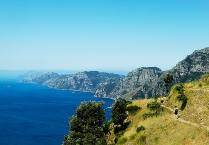
The Path of the Gods (Sentiero degli Dei) is an amazing path between the sky and the sea along the breathtaking hilltop mule tracks of the Amalfi Coast that gets its name from the historical and legendary events which say that the Greek Gods passed along this trail when they went to save Odysseus (also known by the Latin variant Ulysses) from the sirens on the islets of Li Galli. According to Greek mythology, the sirens, who once inhabited the archipelago of the three islets known as Li Galli (Le Sirenuse), bewitched passing sailors with their songs to the point that they would simply ground their ships or become lost at sea. Only the clever Odysseus (who ordered his ship crew to tie him up and block their own ears to prevent themselves from hearing the songs) and Jason (who travelled with a lyre player named Orpheus who had the ability to totally captivate his hearers, more
ignoring the sirens’ songs) with his band of Argonauts, were able to escape the spell of the sirens’ songs. According to the myth, the Path of the Gods was the path the Gods followed when they came down from the heavens to the sea to save Odysseus from the sirens who tried to seduce him by their singing. From this ancient legend in honour of their legendary siren singers came the historic name of Le Sirenuse and the modern name of Li Galli of the islets, as according to Greek mythology, the sirens were half human and half bird (“galli” mean roosters in Italian).
This wonderful natural pathway along the Lattari Mountains stretches across Campania in southern Italy, forming the spiky backbone of the Sorrentine Peninsula. The natural beauty and landscape found along the pathway comes from the fact that man has never interfered here, and the entire route has remained intact, just as Mother Nature created it and moulded over the centuries only by the elements. The trail is immersed amidst lush Mediterranean vegetation, as well as chestnut trees, alders, holm oaks, and bushes, and is the only way of connection between all the medieval villages of the Amalfi Coast for several centuries. It is one of the most famous hiking trails in Italy and can only be covered on foot.
The Path of the Gods (Sentiero degli Dei) is divided into two paths: the classic path known as the “sentiero basso” (low path), starting in Bomerano, a small hamlet in the town of Agerola and ending in Nocelle, nestled in the upper part of Positano on the slopes of Monte Peruso, which is the easiest and most famous path, and the “sentiero alto” (high path), starting in Bomerano and ending in Santa Maria del Castello, which is considered more difficult because the path is uphill and you will have to slightly climb all along the walk.
The low path between Bomerano (in Agerola) and Nocelle (above Positano) is 6 km long and takes about 1.5-2 hours depending on your walking speed and how much you stop to take photos and breaks. It runs gently downhill with magnificent views of the Amalfi Coast and the island of Capri and can be walked by inexperienced trekkers, without any need for special equipment. You will be able to pick up all the materials (maps and guides) you will need for the trek from the InfoPoint in the main square of Agerola, but with the standard marking of the treks, it is hardly possible to get lost.
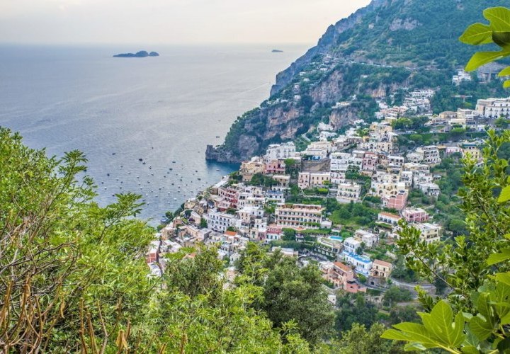
During the hike through the Path of the Gods, you will be able to make a stop at the numerous panoramic terraces to enjoy a breathtaking view of Capri’s Faraglioni (three towering rock formations which jut out from the Tyrrhenian Sea just off the island’s coast), Punta Pennata Island, and the Li Galli Islets (three tiny islands, Gallo Lungo, La Rotonda, and Isola Dei Briganti, rich in mystery and legend, which are now privately owned). Among the natural attractions found along the Sentiero degli Dei are the Grotta del Biscotto (literally translated as “Cave Biscuit” in English), a cavity at 528 m above sea level, whose name comes from its specific geological shape resembling the toasted bread “crackers” from Agerola, and the Villaggi Rupestri (“Rock Villages”), ancient settlements built directly in the rock.
Besides the amazing visual experience all along the walk, the pathway also offers you the possibility to smell the scents and perfumes of the Amalfi Coast. Although the route can be hiked all year long, the best seasons to enjoy the walk are spring and autumn, when it’s not as hot and crowded as in summer. Furthermore, in the spring, you will be able to smell the scents of diverse and spectacular spring blooms such as the Rock rose (both white and pink), Myrtle, Broom and Rosemary.
The high path, which is an extension of the classic Path of the Gods, passing beyond Nocelle and reaching Santa Maria del Castello, is about 9.5 km long and takes about 4-5 hours, depending on your walking speed and how much you stop to take photos and breaks. The trail is rated as difficult and is primarily used for hiking, nature trips, and birdwatching. It is accessible all year-round and follows almost parallel with the low path, offering approximately the same panoramas as those described for the low path. Due to the high elevations of this path, it makes for even more sweeping (panoramic) views of the coast, the island of Capri, the Gulf of Salerno and the little islets of Li Gallli. Moreover, once at Santa Maria del Castello, you will enjoy a fantastic view that opens towards the north, revealing the entire Gulf of Naples (also called the Bay of Naples) with its beautiful islands, the Phlegraean Fields (Campi Flegrei in Italian) and Vesuvius. On a clear day, you can even marvel at the hovering peregrine falcons flying high in the sky.
The most romantic way to try the authentic original Italian pizza is by enjoying it on the seaside of Via Partenope in Naples, offering an awesome landscape of the Bay of Naples.
The true Neapolitan pizza (pizza napoletana in Italian) must be made with either Pomodorini del Piennolo del Vesuvio growing on the volcanic plains to the south of Mount Vesuvius or San Marzano tomatoes, and Mozzarella di Bufala Campana DOP (“Denominazione di Origine Protetta”), a protected designation of origin cheese made with the milk from water buffalo raised in the marshlands of Campania and Lazio regions in a semi-wild state, or Mozzarella STG (“Specialità Tradizionale Garantita”), a cow’s milk mozzarella. It is a Traditional Speciality Guaranteed (TSG) product in Europe, meaning that “Pizzaioli” (pizza makers) must follow a specific method of preparation to call their pizza true Neapolitan pizza. more
The true Neapolitan pizza (pizza napoletana in Italian) must be made with either Pomodorini del Piennolo del Vesuvio growing on the volcanic plains to the south of Mount Vesuvius or San Marzano tomatoes, and Mozzarella di Bufala Campana DOP (“Denominazione di Origine Protetta”), a protected designation of origin cheese made with the milk from water buffalo raised in the marshlands of Campania and Lazio regions in a semi-wild state, or Mozzarella STG (“Specialità Tradizionale Garantita”), a cow’s milk mozzarella. It is a Traditional Speciality Guaranteed (TSG) product in Europe, meaning that “Pizzaioli” (pizza makers) must follow a specific method of preparation to call their pizza true Neapolitan pizza. more
The art of its making is included on the list of UNESCO’s intangible cultural heritage.
To achieve its signature soft, elastic and tender heart with a tall, fluffy edge called the “cornicione”, Neapolitan pizza must meet some specific requirements. According to the rules proposed by the True Neapolitan Pizza Association (“Associazione Verace Pizza Napoletana”), the genuine Neapolitan pizza dough must contain wheat flour (type 0 or 00, or a mixture of both), yeast, salt and water. The dough should be hand-kneaded with no more than 35 cm in diameter and may be no more than 3 mm thick with a slightly raised edge. The “cornicione”, also described as an identifying feature of Neapolitan pizza, should be an airy, raised edge of 1-2 cm with dark bubbles, that’s crunchy on the outside and light and soft on the inside. To make the perfect “cornicione”, the “pizzaiolo” has to start with a good flour, allow a long, slow fermentation time and bake the pizza in a hot wood-fired oven.
In order to try the original Italian pizza, choose the simple and classic Margherita or Marinara, which are so tasty that do not require any further ingredients.
Pizza Margherita is a typical Neapolitan pizza, that follows the essential rules for the ingredients and is made with San Marzano tomatoes, mozzarella cheese, fresh basil, extra-virgin olive and salt. It was created by Pizzeria Brandi’s chef named Raffaele Esposito in 1889 for the Queen of Italy, Margherita of Savoy, shortly after Italy’s unification (1861), and its toppings - tomato (red), mozzarella (white) and basil (green) - were inspired by the colours of the national flag of Italy. You can enjoy a Pizza Margherita with cow’s milk mozzarella, or opt for a Pizza Margherita with Mozzarella di Bufala Campana DOP, often listed on menus as “Margherita Extra” or simply “Pizza Margherita con Mozzarella di Bufala”.
Another typical Neapolitan pizza is Pizza Marinara, also known as Pizza alla Marinara, which is made with tomatoes, garlic, oregano and extra virgin olive oil. It is supposedly the most ancient tomato-topped pizza and was invented in the oldest pizzeria in the world, a restaurant called Pizzeria Port’Alba, in 1734. It has got its name from the fishermen who ordered this pizza on their return home from fishing in the Bay of Naples.
Thanks to its unique geological formation, Italy has many natural hot springs from north to south, offering a fantastic way to relax and enjoy the beauty of nature. From ancient Roman times, the thermal baths became a real tradition and were included in everyday life. After all, what can be more relaxing and refreshing than soaking in a natural hot spring with endless health and beauty benefits? The natural hot springs of Italy offer beautiful landscape views, many health benefits and a wonderful possibility to relax between city tours, and can be found in many Italian regions, but Tuscany is the most common region to find them and one of the best spa destinations in the world. Below you can find some of the best Italian hot springs that are definitely worth a visit.
Located in the heart of Tuscany, more
Located in the heart of Tuscany, more
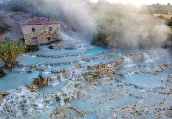
just a few kilometres from Saturnia village, the Saturnia hot springs are some of Italy’s best hot springs. They are the most spectacular hot springs and one of the best-kept secrets of the country, and soaking in these springs is an absolute must-do in Italy. Among the different tanks, the most famous are certainly those fed by the ancient Cascate del Mulino (Mill Waterfalls), which are on the grounds of an old mill. Located about two hours from Siena and three hours from Rome, the springs run from Mount Amiata and the surrounding hills of Maremma and are completely free to visit all year round. The silk blue sulphuric waters, heated by the nearby volcano, flow down on different levels forming large open-air thermal ponds (pools) with a temperature of 37.5° C throughout the year. The natural almost oval-shaped pools arranged on superimposed floors are created from limestone deposits, whose whiteness gives an almost supernatural aspect to the landscape. It is almost unreal that this place which bestows a dreamlike atmosphere exists and that everyone can enjoy it for free at all hours of the day and night.
The name of the springs comes from the Roman god of Saturn, who, according to the legend, created the springs to pacify mankind. Today, the number of tourists who come here looking for the blue-coloured curative waters and the sulphur-rich mud, known for reducing high blood pressure and treating various skin diseases, is still relatively small. Therefore, depending on the season and the time of the day, you could enjoy a pretty intimate and romantic atmosphere. The best option to arrive here is by a rented car in order to fully enjoy this marvellous attraction during the day and at night. You can spend the night at a nearby resort, where you can also opt for additional spa services.
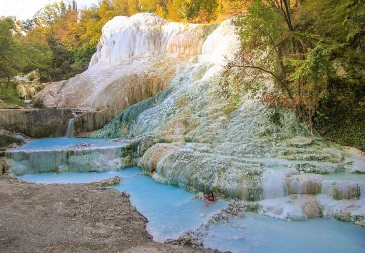
Other impressive hot springs in Tuscany are the Fosso Bianco hot springs, which represent calciferous formations, waterfalls and small outdoor ponds (pools) of hot water surrounded by woodlands in the village of Bagni San Filippo on the eastern side of Mount Amiata, in the Val d’Orcia. If you are in Florence, these springs, located about 2 hours from the city, are actually closer than the Saturnia springs. The largest and the most impressive calciferous formation of Bagni San Filippo is called the Balena Bianca (White Whale) for its similarity to the mouth of a whale. Flowing down the calcium-carbonate encrusted rock at 48° C, the warm white-blue water, contrasting with the green and copper shades of the woods, provides the perfect all-year-round bathing experience. The calciferous formations at the hot springs are delicate, and you should not walk on them, but instead sit at the bottom of the pools, where you can find a rich deposit of thermal mud providing one of the best free spa treatments that Mother Nature can offer. If you go to the hot springs in the evening, you can spend the night at the nearby hotel that also uses the hot springs for its pool and beauty and health treatments. Bagni San Filippo village is within the Natural, Artistic and Cultural Park of the Val d’Orcia declared a UNESCO World Heritage Site as a cultural landscape.
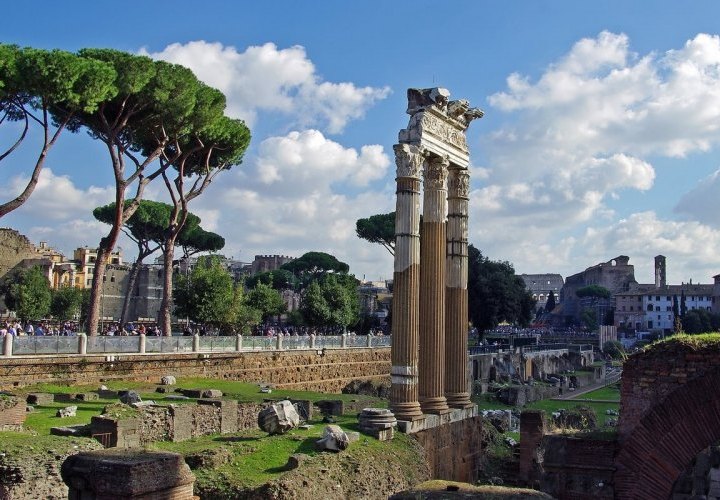
Rome is an outdoor museum and the best way to breathe in its history is by walking along the Imperial Fora, representing one of the most famous archaeological and historical areas in the world. The Imperial Fora are a number of monumental public squares built in the centre of Rome over a period of one and a half centuries, between 46 BC and 112 AD, as follows: Forum of Caesar (46 BC), Forum of Augustus (2 BC), Temple of Peace (75 AD), Forum of Nerva (97 AD) and Forum of Trajan (113 AD). Located relatively close to each other, they were the centres of politics, religion and economy in the ancient Roman Empire. Today, you can see ruins from all five of these Imperial Fora, but the best-preserved and the largest of all is the Forum of Emperor Trajan. The forum was built on the order of the emperor Trajan after the conquest of Dacia, more
which ended in 106 and includes the Trajan’s Column that survived almost intact in the ruins of the forum. They all are well-lit at night and can be viewed free of charge at any time from the Via dei Fori Imperiali, but the best time to discover them is early in the morning, when the Eternal City is still sleeping. The road appeared in the centre of the city of Rome, when between 1932 and 1933, Mussolini decided to “cut” into two the “Way of the Empire” complex building, by building a rectilinear path for military parades. The Via dei Fori Imperiali runs in a straight line from the Piazza Venezia to the Colosseum and presents a tourist itinerary beyond comparison that moves even the most experienced tourists. The Imperial Fora can be seen in as little as an hour, after which you can walk along the Via dei Fori Imperiali and reach the Colosseum.
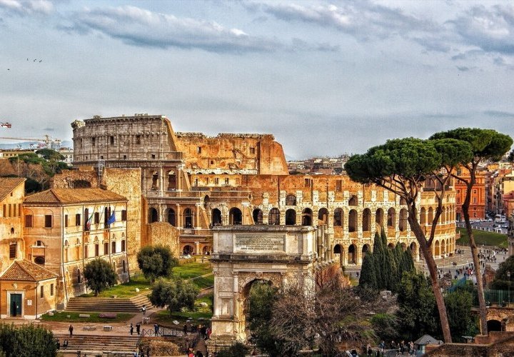
The Colosseum is an impressive amphitheatre in the centre of Rome, whose construction began in 72 AD, under the emperor Vespasian, and was finished in 80 AD, under his successor and heir, Titus, known as the Flavian dynasty. Despite its age, it’s the largest ancient amphitheatre ever built, and still the largest standing amphitheatre in the world today. The Colosseum, known upon completion as the Flavian Amphitheatre, was used for gladiatorial contests and public spectacles until the early medieval era, being later used as a church, a fortress, a quarry, and a Christian shrine. You will be amazed by this magnificent amphitheatre built of travertine limestone, brick-faced concrete, and tuff (volcanic rock), that could hold an estimated 50,000 to 80,000 spectators. If you wish to enter the Colosseum, you can book tickets online in advance and choose between the diverse options, including a visit to the Colosseum only or a visit to the Colosseum, Roman Forum and Palatine Hill. Choosing the first time slot in the morning on your ticket will allow you to be one of the first persons to enter the venue, bypassing long queues. Make sure to get there before it opens, as it has a maximum capacity and once that is reached, people must wait in the queue until people who entered earlier have left. You can also opt for a guided tour of the Colosseum (its Underground and Arena Floor), Roman Forum and Palatine Hill in a small group of people and arrive at the meeting point 15 minutes before your chosen timeslot. If you don’t want to book tickets online, arriving before the opening time, will allow you to buy a ticket at the Colosseum ticket office when there’s no waiting line. With all the ancient sites to visit in Rome, it’s a pity to leave Rome without any real sense of life in the ancient city.
The Colosseum is an impressive amphitheatre in the centre of Rome, whose construction began in 72 AD, under the emperor Vespasian, and was finished in 80 AD, under his successor and heir, Titus, known as the Flavian dynasty. Despite its age, it’s the largest ancient amphitheatre ever built, and still the largest standing amphitheatre in the world today. The Colosseum, known upon completion as the Flavian Amphitheatre, was used for gladiatorial contests and public spectacles until the early medieval era, being later used as a church, a fortress, a quarry, and a Christian shrine. You will be amazed by this magnificent amphitheatre built of travertine limestone, brick-faced concrete, and tuff (volcanic rock), that could hold an estimated 50,000 to 80,000 spectators. If you wish to enter the Colosseum, you can book tickets online in advance and choose between the diverse options, including a visit to the Colosseum only or a visit to the Colosseum, Roman Forum and Palatine Hill. Choosing the first time slot in the morning on your ticket will allow you to be one of the first persons to enter the venue, bypassing long queues. Make sure to get there before it opens, as it has a maximum capacity and once that is reached, people must wait in the queue until people who entered earlier have left. You can also opt for a guided tour of the Colosseum (its Underground and Arena Floor), Roman Forum and Palatine Hill in a small group of people and arrive at the meeting point 15 minutes before your chosen timeslot. If you don’t want to book tickets online, arriving before the opening time, will allow you to buy a ticket at the Colosseum ticket office when there’s no waiting line. With all the ancient sites to visit in Rome, it’s a pity to leave Rome without any real sense of life in the ancient city.
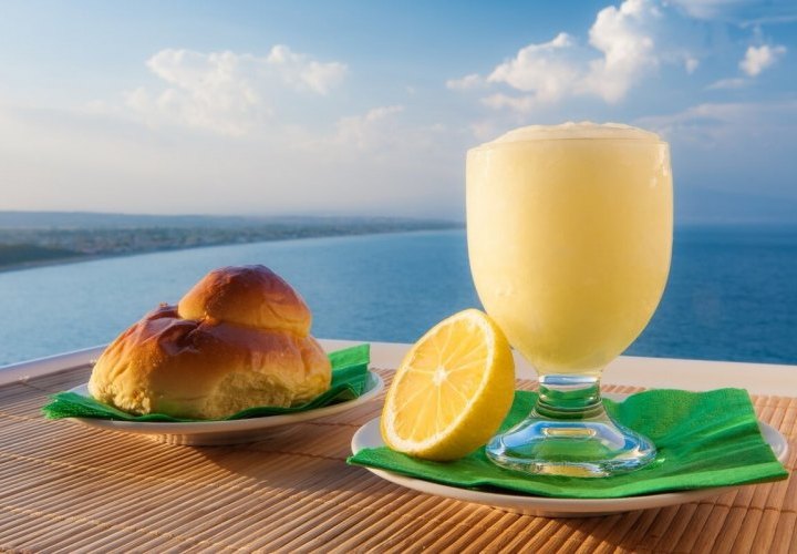
In Sicily, where it’s very hot in summer, locals prefer to start their summer days on a sweet and refreshing note, with granita and brioche for breakfast (or whenever there is a good enough excuse). If you want to “live like a local” and really experience Sicily, you should not miss the chance to enjoy a cold granita (a Sicilian dessert made of water, sugar and fruit that is slowly but never fully frozen) with a warm “brioche col tuppo” (a typical Sicilian brioche characterized by the presence of a “hat” or “knot” in the upper part of the brioche called “tuppo”). The Sicilian granita is mixed continuously to obtain a grainy, but at the same time creamy consistency and has different flavours including lemon (the most traditional flavour), almond (the most requested flavour), more
pistachio of Bronte, coffee, chocolate, strawberry, mulberry or peach flavours. You should immediately detach the “tuppo” and soak it into the granita, as if this was a cappuccino.
Once served only at breakfast, today granita and brioche are eaten at any time of the day. Although the Sicilians have come up with granita and brioche in order to refresh the senses in summer, this local treat is so good that it is hard to resist it at any time of the year. If you visit Sicily during winter, don’t worry, as you will find this local delight at every bar and café throughout the year. The combination of cold, grainy and creamy granita with warm and soft brioche with a light and dark crust will give your senses a kick-start, making it a perfect match to enjoy a slice of summer or winter.
If you are passing through Messina, make sure to try the city’s coffee-flavoured granita that was recognized as a traditional local product and granted a Local Denomination (“Denominazione Comunale”) label. In Messina, coffee-flavoured granita has a coarser structure and is often called “mezza con panna” (which translates as “half with cream”), the local term used to indicate a coffee granita with whipped cream. “Mezza con panna” only refers to coffee-flavoured granita, which is traditionally served in a classic glass cup with a warm brioche on the side. Although it can be enjoyed as a regular dessert at any time of the day, Sicilians prefer to order a coffee-flavoured granita as a sweet breakfast option.
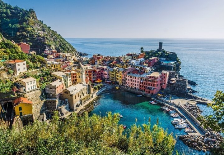
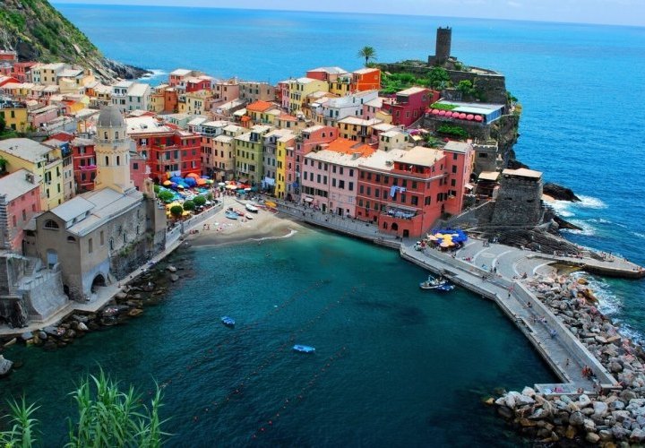
The charming Cinque Terre villages (Monterosso al Mare, Vernazza, Corniglia, Manarola and Riomaggiore) are connected between themselves by walking cliff-side trails, trains and boats. Due to the fact that this portion of coast full of bays and headlands is rugged and steep, cars can only reach the villages with great difficulty through narrow winding roads. So, walking through this coastal area is one of the best options to move between the villages. They represent one of the most scenic Italian corners, and definitely the hikers’ paradise. The Cinque Terre ("Five Lands") are five romantic places with colourful houses, arranged one upon another like stairs, being part of Cinque Terre National Park and a UNESCO World Heritage Site. Everyone should walk along these paths at least once in a lifetime.
The Blue Path (Sentiero Azzurro) is the easiest and the most popular path in the entire Cinque Terre. more
The Blue Path (Sentiero Azzurro) is the easiest and the most popular path in the entire Cinque Terre. more
It has a total length of 12 km, connects all the five villages of the Cinque Terre and is divided into four sections.
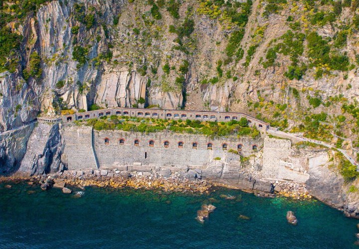
One section of the Blue Path, named La via dell'Amore or The Path of Love, is the shortest and the most popular hiking trail in Cinque Terre National Park. It is a pedestrian path overlooking the sea with a length of 920 m, that connects the villages of Manarola and Riomaggiore. The trail passes just at the foot of the mountains (maximal height of 45 m), takes about 20 - 30 min and is one of the most important tourist attractions in the area. It came up in the 1920s, when the railway tunnel between these two villages was constructed, as workers needed to cut a path right into the cliffs through solid rock, in order to move easily between the two villages. After works on the railway were completed, the villagers asked that the footpath be kept open, so that they could trade fruits, vegetables and other goods. Although the construction of the stone path along the sheer cliffs between Riomaggiore and Manarola was undoubtedly very helpful for trade, it also provided an easy and private place to meet for the young lovers who lived in the two villages. Currently, only a small part of the trail (the first 200 metres from the Manarola side) are open, while the main part of the trail is closed approximately until May 2024 due to extensive engineering work.
The second most-known trail in the Cinque Terre after the Path of Love is the Path from Monterosso to Vernazza or vice-versa. It has a length of 3.3 km, takes about 2 hours and is famous for its diversity of landscapes, including slopes and rises, and greenery. If you plan to walk in the morning, start the trail from Vernazza, while if you want to walk in the afternoon, it’s better to start from Monterosso, in order to avoid the sun in your face. But, if you also want to avoid crowds, it’s better to start walking early in the morning or in the evening. The path from Monterosso side abruptly gains height from sea level to 175 m, making you go up 500 steps, paved on the ancient path, which are in a relatively good shape. Therefore, once in a while you will have to stop and catch your breath, as the steps on the trail can be very high. On your way from Vernazza, you will also have a rise, but not a steep one. However, you are recommended to go from Monterosso to Vernazza because, in this case, climbing up is easier than going down.
The walk begins from the older part of Monterosso on the Via Corone road in Monterosso and ends near the Santa Margherita di Antiochia Church in Vernazza. In Monterosso, you will find yourself near the lovely beach of the historical centre, closed in by the small port and the railway viaduct. You will have an unforgettable stroll near evergreen oaks, vineyards, broom bushes, and junipers. Not far from Vernazza, there are two beautiful areas, where tourists stop to take pictures from the height of a bird’s flight (about 150 metres).
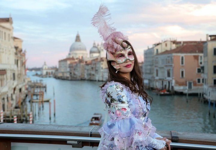
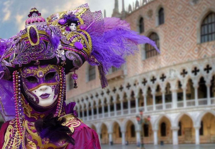
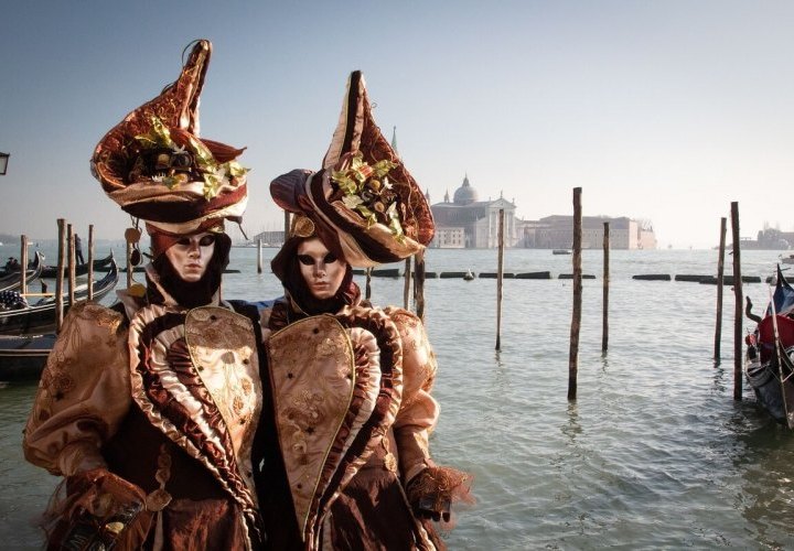
The Carnival of Venice (Carnevale di Venezia) is an annual festival held in late January or early February (depending on the year) in Venice when many sumptuous costumes and traditional Venetian masks transform the city in a spectacular way. It is one of the most famous carnivals around the world with centuries old traditions that attracts each year about 3 million tourists who come to Venice to see the sumptuous costumes and masks parades. The carnival usually lasts a couple of weeks, but the most important days are those between the last Thursday (Giovedì Grasso) and the last day Tuesday (Martedì Grasso), which is the day before the start of Lent on Ash Wednesday. However, many important festivities for this festival come alive on the weekends, especially the final weekend of the event. The only thing you should do in the Carnival of Venice is choose a mask, more
wear it, get lost in the multitude of people participating in the event and let yourself be admired!
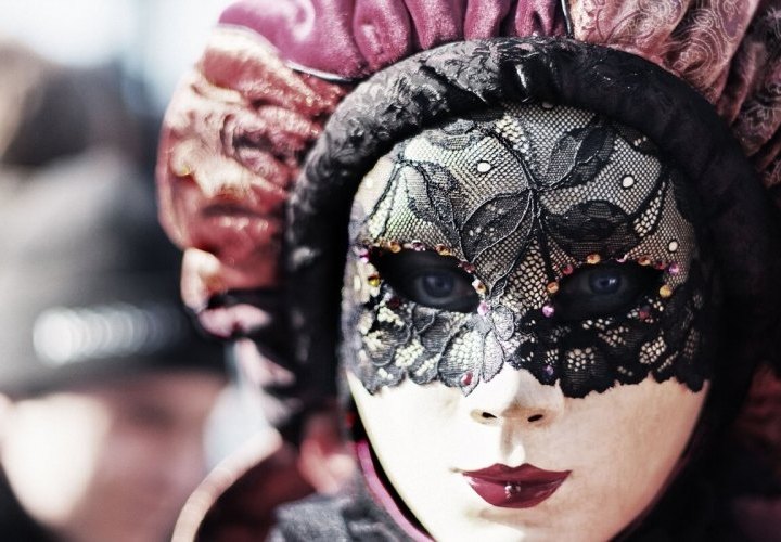
The carnival is thought to have started in 1162 A.D., in order to celebrate the victory of the Venetian Republic over the Patriarch of Aquileia, Ulrico di Treven, and became an official public holiday only in 1296. Wearing masks and costumes during the Venice Carnivals allowed people to protect their identity, hide any social differences, and even make fun of the aristocracy. Creating masks is a tradition followed over hundreds of years in Venice, making the carnival of Venice truly unique. You can buy a mask as soon as you get in the city, in any of the small stands or shops, but it is better to do it in the city centre, where ancient shops or ateliers still produce masks according to the ancient art. Among the most famous masks are the so-called: bauta, a white mask under a black hat and cloak, designed to comfortably cover the entire face; moretta, a dark oval mask with wide eyeholes and no lips or mouth worn by patrician women, that was held in place by a button in the mouth; or volto (larva), the modern Venetian mask, often made of white porcelain or thick plastic, which is frequently decorated. Choose your favourite mask and attend this beautiful event, consisting of several weeks of festivities, including parades, public shows and exhibitions with musicians, dancers and acrobats, as well as parties, and masked plays hosted by theatres.
The carnival is thought to have started in 1162 A.D., in order to celebrate the victory of the Venetian Republic over the Patriarch of Aquileia, Ulrico di Treven, and became an official public holiday only in 1296. Wearing masks and costumes during the Venice Carnivals allowed people to protect their identity, hide any social differences, and even make fun of the aristocracy. Creating masks is a tradition followed over hundreds of years in Venice, making the carnival of Venice truly unique. You can buy a mask as soon as you get in the city, in any of the small stands or shops, but it is better to do it in the city centre, where ancient shops or ateliers still produce masks according to the ancient art. Among the most famous masks are the so-called: bauta, a white mask under a black hat and cloak, designed to comfortably cover the entire face; moretta, a dark oval mask with wide eyeholes and no lips or mouth worn by patrician women, that was held in place by a button in the mouth; or volto (larva), the modern Venetian mask, often made of white porcelain or thick plastic, which is frequently decorated. Choose your favourite mask and attend this beautiful event, consisting of several weeks of festivities, including parades, public shows and exhibitions with musicians, dancers and acrobats, as well as parties, and masked plays hosted by theatres.
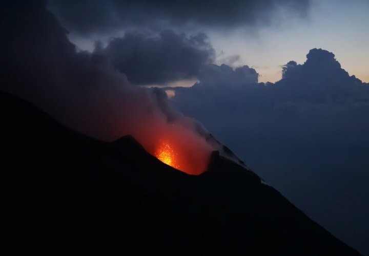
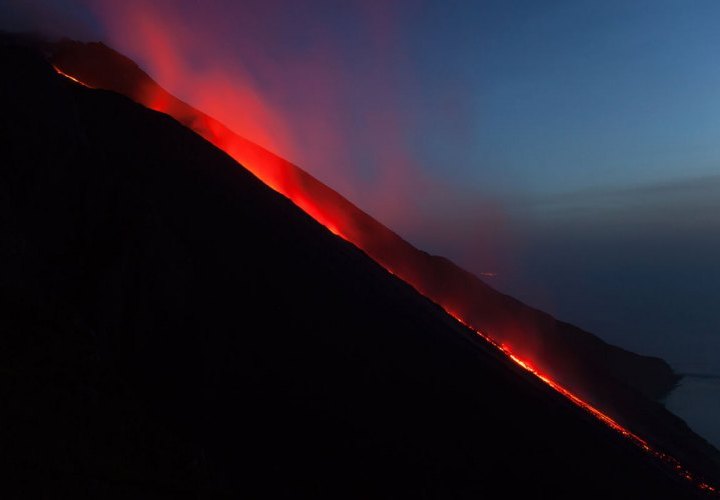
Stromboli is one of seven Aeolian Islands off Sicily’s northern coast, listed by UNESCO in 2000 as a World Heritage Site. The island has one of the most active volcanoes in the world, famous for its normally small, but regular explosions that have been going on for at least 2,000 years. The Stromboli Volcano, measuring just 924 m above sea level, has three active craters at the peak and a significant geological feature named Sciara del Fuoco (Stream of Fire). It is a talus scree or depression formed as a result of a sector collapse on the northwestern side of the cone about 5,000 years ago. This never-ending active volcano puts on a special show by throwing out glowing lava containing ash, reddish lapilli, volcanic bombs, and incandescent waste from its summit craters.
During active periods, more
During active periods, more
strombolian eruptions occur about every 20 minutes and are accompanied by a distinctive belly-roar as gases force hot magma into the air. After particularly strong eruptions, you can watch the red-hot lava flowing down from the plateau onto the Sciara del Fuoco, creating visible splashes as it falls into the sea. The most popular activity for viewing Stromboli’s explosions is renting a boat for seeing the volcano’s summit and the Sciara del Fuoco (just below the explosive craters) from the sea. For best viewing, take a boat trip after dark, when the livid red Sciara del Fuoco and exploding cone are extremely visible. You will be amazed by the special show offered by the natural sparkling fireworks of the volcano, bursting into a symphony of reddish lapilli against the night sky. If you are lucky, you will also see the lava river diving into the sea under the starry night sky and understand why the volcano is a major tourist attraction on the island.
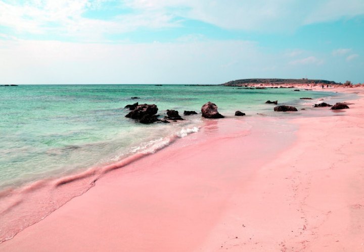
The island of Sardinia, off Italy’s west coast, has some of the finest beaches in Italy, including the pink sand beaches of the Costa Smeralda in northern Sardinia and Budelli Island in the Maddalena Archipelago and the sparkling multicoloured quartz beaches found on the Sinis Peninsula with Caribbean-blue seas and picturesque landscapes.
The Emerald Coast (Costa Smeralda) is one of the best-known corners of Sardinia with a shoreline stretching around bays and inlets for around 20 km. The largest beach on the Costa Smeralda is the Liscia Ruja Beach (Spiaggia di Liscia Ruja) also known as the Long Beach, located between the villages of Cala di Volpe and Portisco in front of the islands of Soffi and Mortorio. It is a wide sand beach which has the form of an arc or a crescent moon and is located along a shallow bay. more
The Liscia Ruja Beach is possibly one of the most perfect beaches in the Mediterranean, being very famous for its fine and silky white sand, which turns pink (reddish at times) as it reaches the incredibly turquoise and crystal-clear sea. This particular colour from which comes the name of the beach (“Ruja” means “Red”) is due to the presence of granite and shell particles. You will be amazed by the narrow and long strip of fine pink sand located between the wider strip of fine white sand and the immense and pure turquoise sea. The view is completed by the green Mediterranean vegetation, including junipers, exotic citrus trees and strawberry trees, which form the outer side of the beach, and the smooth Sardinian boulders at either end of the beach. The Liscia Ruja Beach is both free and equipped with loungers and parasols for hire in its centre. There are also some car parks and a cafe-bar with delicious food and soft drinks. You can rent boats, canoes, kayaks and hydrocycles offering impressive sea experiences. Due to its shallow waters, length (about 700 m) and width, the beach is perfect for families with children and is never crowded. If you don’t want to hire a lounger in the central area of the beach, its length allows you to find a nice spot in the morning even during the peak season (mid-August) at either end of the beach, where it is practically untouched.
It is possible to get to the Liscia Ruja Beach by your own car or by a car rented in advance. In order to reach the beach, you can take the sandy path from the famous Cala di Volpe Beach (you can stay at the hotel located near the beach) that goes on for about 3 km until you reach the car park located at its northern end. It is unspoiled and takes some time to reach, but it is definitely worth the effort.
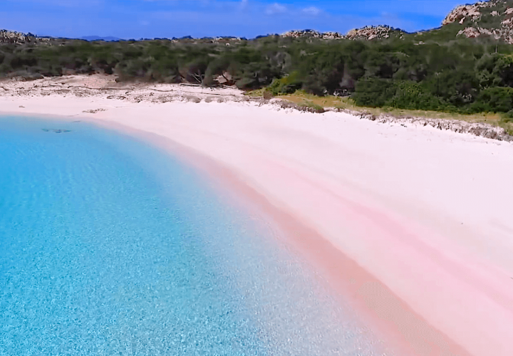
Another magical beach, which is entirely covered with pink sand, is the Spiaggia Rosa (Pink Beach) located on Budelli Island, one of the seven islands that make up the Maddalena Archipelago in the Strait of Bonifacio between north-eastern Sardinia and Corsica (France). The Maddalena Archipelago, with its islands including Budelli, was designated a national park, known as the Maddalena Archipelago National Park (Parco Nazionale dell' Arcipelago di La Maddalena) and is a popular tourist destination among boaters.
The Spiaggia Rosa is one of the world’s most beautiful beaches and one of the few places on the planet to have pink sand. The spectacular pink colour of its sand rich in tiny fragments of granite is mostly due to a microorganism known as Miniacina Miniacea that lives in a pink shell in the underwater posidonia meadows. When the microorganisms end their life cycle, the pink limestone shells form a sediment on the seabed, being further transported by the marine currents until they finally reach the beach, mix with the sand and give it the pink colour.
Due to the fact that the irregular agitation of the sea caused by anchoring boats slowed down posidonia growth and modified the composition of the sand, and the action of taking jars of pink sand away by the visitors resulted in the loss of its colour, it is currently forbidden to access the beach, swim between the marker buoys, disembark and anchor boats. It is possible, however, to admire the beach during a boat trip or by walking along the Strada Rosa (Pink Road), a path between junipers and Mediterranean scrub especially designed in Budelli for admiring the Pink Beach or the Strada Azzurra (Blue Road), a path that crosses the centre of Budelli to reach the Spiaggia del Cavaliere (Beach of the Knight). You will be able to smell the intense aromas coming from the coast of low plants such as helichrysum, rosemary or wild lavender. If you opt for a boat trip, you may see dolphins that regularly frequent the region.
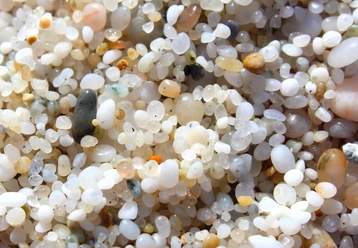
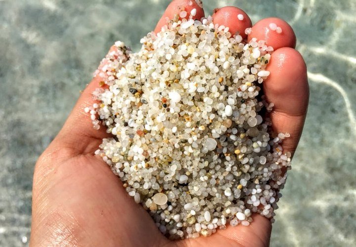
On the Sinis Peninsula in central-western Sardinia, in the province of Oristano, in the municipality of Cabras, you can find beautiful beaches, whose sand includes sparkling multicoloured quartz crystals. They were created by nature as a result of the erosion of the mountainous Island of Mal di Ventre, which is now a flat expanse of granite of two and a half kilometres facing the Sinis Peninsula. During a large period of time that took millions of years, the atmospheric agents like the wind and the waves eroded the granite rocks containing quartz and feldspar, making them to slowly disintegrate, becoming sediment transported to the sea (bed load), where it accumulated to form the nearby beaches of Is Arutas, Mari Ermi and Maimoni. The small grains of glassy quartz and opaque feldspar are of different colours, including white, pale pink, green, orange and grey, making at least one of these beaches a must-see attraction during your stay in Sardinia.
Considered the pearl of the Sinis Peninsula, Is Arutas Beach is one of the most popular quartz beaches in the Gulf of Oristano. It is known as the “beach of the rice grains”, as “Is Arutas” in Sardinian language means “rice grains”. You will be impressed by the magical multicoloured grains of ultra-thin quartz, similar to the grains of rice, which reflect in a spectacular way when exposed to the direct sunlight, and the various hundreds of metres of turquoise sea, which is crystal clear and allows you to admire the marine life and its bottom. While underwater, you will see little fish swimming near the posidonia formations and discover the beautiful natural treasures. The beach is small, free and popular among windsurfers and kite surfers. In the immediate vicinity of the beach, there is a car park, a kiosk/bar, and a camping area. Is Arutas Beach is perfect for those who love to relax in a spectacular landscape lying on the tiny pebbles of unparalleled beauty.
To the north of Is Arutas, there is a “twin” jewel, Mari Ermi Beach, covering two and a half kilometres, all the way to Portu S'Uedda, in front of the Mal di Ventre Island, where sea turtles lay their eggs. The beach is characterized by the same tiny pebbles of multicoloured quartz with multiple hues and is protected from behind by a large 20-hectare pond (Stagno di Mari Ermi), where you can see many species of marine birds, including flamingos. Due to its shallow seabed, sloping gently out towards the open sea, the Mari Ermi Beach is ideal for families with children. The Mistral winds make it the perfect place for wave sports such as kitesurfing and windsurfing. In the area, you will find several services such as parking, places for dining and refreshments, and campsites.
In order to fully enjoy the quartz beaches of the Sinis Peninsula, you can look for accommodation between Cabras town and Putzu Idu village. Due to the fact that year after year, the sea erodes the quartz beaches of the Sinis Peninsula, thus gradually reducing their size, and because, on the other hand, there are no more sediment reserves that can be deposited on them, it is prohibited to take the quartz sand from these beaches.

