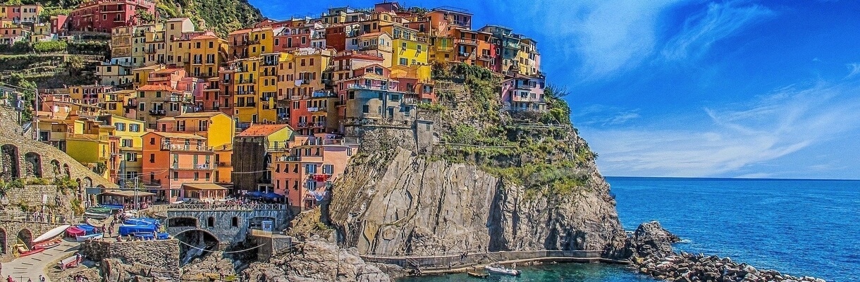
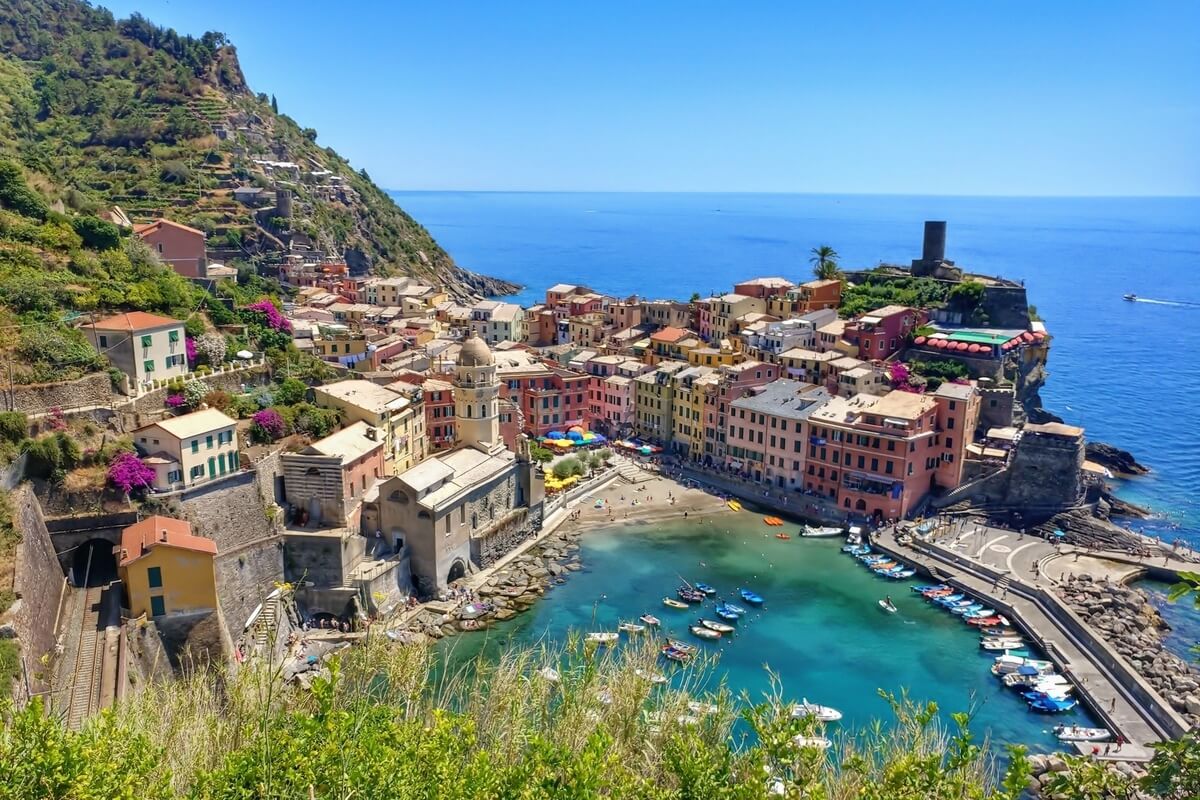
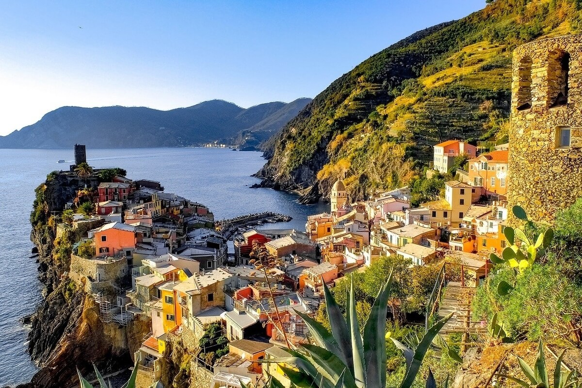
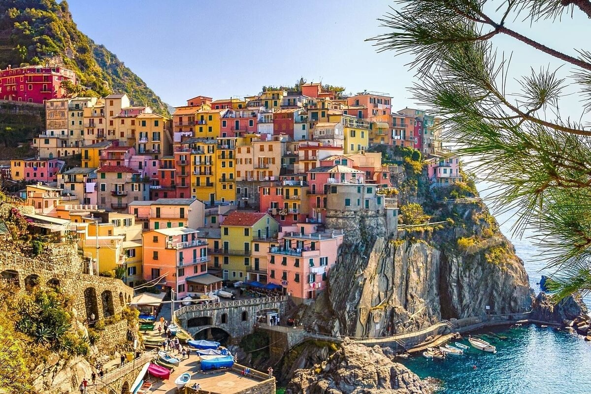
Located in the province of La Spezia, Liguria, northern Italy, Cinque Terre National Park (Parco Nazionale delle Cinque Terre) is a protected area inducted as the first national park of Italy in 1999. Although it is the smallest national park in Italy at 4,300 acres, it is also the densest with 5,000 permanent inhabitants among the five towns of Cinque Terre (Riomaggiore, Manarola, Corniglia, Vernazza and Monterosso al Mare). In addition to the territory of the five towns, it also encompasses parts of the communes of Levanto (Punta Mesco) and La Spezia (Campiglia Sunsets) and was declared a UNESCO World Heritage Site in 1997.
The National Park has an essential role in protecting and maintaining the natural landscape while promoting sustainable tourism that is vital to the economic success of Cinque Terre. more
The National Park has an essential role in protecting and maintaining the natural landscape while promoting sustainable tourism that is vital to the economic success of Cinque Terre. more
It has many environmental and cultural peculiarities to safeguard and preserve, such as the sheer coasts, the cliffs hanging on the sea with many lovely bays and beaches, the characteristic ancient rural buildings, the grapevine terraces, the medieval suburbs, sanctuaries, etc. It consolidates the relationship between the human being and the environment by a series of panoramic trails, which link the five cliff-side towns on the Ligurian Coast. One of the most popular and easiest hiking trail in the park is the Blue Trail (Sentiero Azzurro) that connects all the five villages and has a total length of 12 km. It is divided into four sections and is the shortest route between two villages with the track passing close to the sea.
Cinque Terre is a tourist destination that draws people from all over the world (about 3.5 - 5 million in the month of August alone) and the goal of Cinque Terre National Park is to maintain the ecosystem in a functional state by keeping the fine balance between the human being and the natural environment. In order to protect and maintain proper usage of the sea off the coast of Cinque Terre, the Protected Marine Area was founded in 1997. It is subdivided into 3 zones: the Strict Nature Reserve, where the boaters are prohibited, the General Nature Reserve, allowing access to motor boats, registered retail fishermen and guided scuba diving tours and the Partial Nature Reserve allowing monitored recreational fishing.
Even though the Mediterranean flora is present in the park, the microclimates, often different from each other, created a huge variety of vegetation. There are pine, Aleppo pine, cork and chestnut trees, many Mediterranean species such as samphire and sea cineraria produced by rock and coastal environments, shrub rosemary, thyme, helichrysum and lavender in the park. The mild climate is also a perfect location for several fauna species including birds such as the gull, the peregrine falcon and the raven, mammals such as the dormouse, weasel, mole, badger, marten, fox and wild boar, reptiles that thrive in the rock such as the common wall lizard, the lizard and various snakes including the rat snake, the grass snake of Aesculapius and the viper and live amphibians around streams like frogs and salamanders.
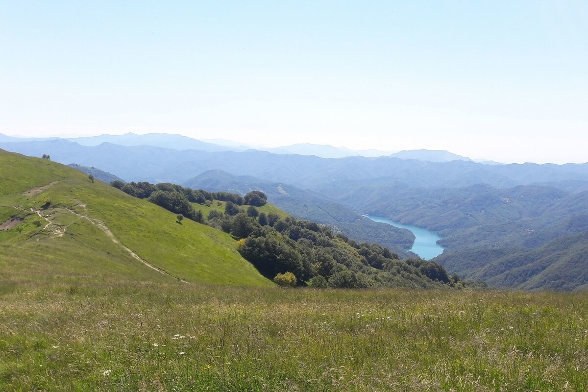
Antola Natural Regional Park (Parco Naturale Regionale dell'Antola) is located in the inland of the Italian Riviera between Genova and Rapallo and gets its name from the highest mountain of the area, Monte Antola (1,597 m).
The park was established in 1985, covers over 48 square kilometres and encompasses the uppermost part of four short valleys: Val Vobbia, Val Pentemina, Val Brevenna and Val Trebbia. The protected area is mainly situated near the border with Piemonte and south of the Apenninic watershed, which divides Pianura Padana (tributary of the Adriatic Sea) from the Ligurian Sea drainage basin. Besides Monte Antola, some of the highest summits located in the park are Monte Buio (1,497 m) and Monte Prelà (1,406 m).
The flora of the park includes impressive chestnut groves and Antola pasture lands, more
which today are an interesting destination for hiking or trekking. A rocky summit with interesting climbing routes and a via ferrata is Rocche del Reopasso (956 m). Monte Reale (902 m) bears an old Catholic sanctuary on its top and a free mountain hut open all year next to the church. About 270 km of footpaths, mostly signposted, are available within the park. At 1,460 m near the summit of Monte Antola, a mountain hut, the Rifugio Parco Antola, that can accommodate up to 32 hikers or alpinists, was built by the Ente Parco and is currently managed by the Club Alpino Italiano.
The fauna includes animals such as wolf, roe and fallow deer, birds such as common buzzard (Buteo buteo), Eurasian sparrowhawk (Accipiter nisus), common kestrel (Falco tinnunculus), European honey buzzard (Pernis apivorus), European green woodpecker, common kingfisher (Alcedo atthis), and red-legged partridge.
The fauna includes animals such as wolf, roe and fallow deer, birds such as common buzzard (Buteo buteo), Eurasian sparrowhawk (Accipiter nisus), common kestrel (Falco tinnunculus), European honey buzzard (Pernis apivorus), European green woodpecker, common kingfisher (Alcedo atthis), and red-legged partridge.
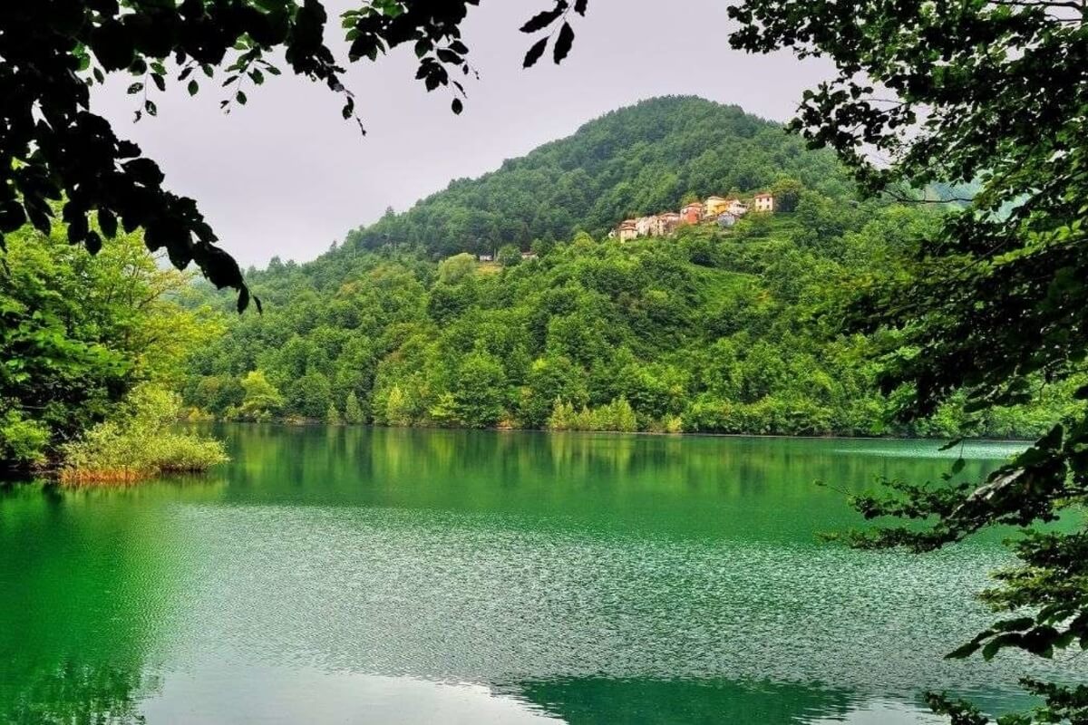
Situated in the inland of the Tigullio area, in the province of Genoa, Aveto Natural Regional Park (Parco Naturale Regionale dell'Aveto) was established in 1995 and protects one of the most stunning and important areas of the Ligurian Apennines mountain range.
Aveto Natural Regional Park is over 30 square kilometres large and includes three different valleys, each with its particular features: the Aveto Valley (featuring high-mountain landscapes, grazing lands and large beech tree woods), the Graveglia Valley (including a well-preserved rural landscape with many olive groves and vineyards, a great variety of rocks and minerals and therefore quarries and mines) and the Sturla Valley (composed of meadows where you can see cattle grazing, chestnut tree and hazelnut tree woods, more
Aveto Natural Regional Park is over 30 square kilometres large and includes three different valleys, each with its particular features: the Aveto Valley (featuring high-mountain landscapes, grazing lands and large beech tree woods), the Graveglia Valley (including a well-preserved rural landscape with many olive groves and vineyards, a great variety of rocks and minerals and therefore quarries and mines) and the Sturla Valley (composed of meadows where you can see cattle grazing, chestnut tree and hazelnut tree woods, more
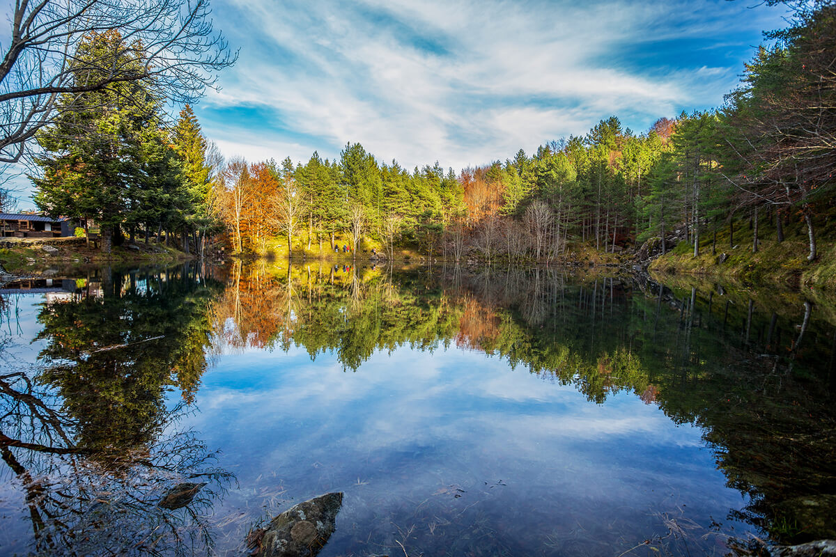
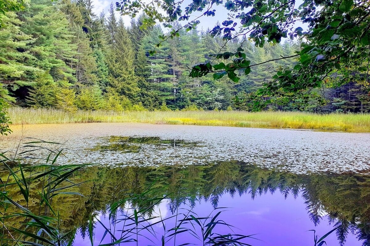
vegetable gardens and olive groves). Thanks to such an extraordinary variety of environments, the park preserves a vast and rich plant life: there are beech tree woods and oak woods, mixed woods with European hornbeam and Flowering Ash, and also thin strips along the rivers characterized by willows and alders; a great floristic richness including 39 endemic plants among which the bird's-eye primrose (primula farinosa), the alpine columbine (aquilegia alpina), Cavillier's Pansy, etc.; and wet habitats near the Lame lakes, perfect for a very special small and rare Italian edible mushroom, the Calocybe Gambosa.
The fauna includes mammals such as the wolf, which is mainly present in this area; birds such as the Hen Harrier (Circus cyaneus), Eurasian Nightjar (Caprimulgus europaeus), Red-backed Shrike (Lanius collurio), Golden Eagle (Aquila chrysaetos), European Honey Buzzard (Pernis apivorus), Black-winged Stilt (Himanthopus himanthopus); insects such as the day-flying moth known as Jersey Tiger (Callimorpha quadripunctaria), Great Capricorn Beetle (Cerambyx cerdo) and the impressive, globally threatened Stag Beetle (Lucanus cervus); species of fish such as Western Vairone (Leuciscus souffia) and crustaceans such as the European Freshwater Crayfish (Austropotamobius pallipes).
The fauna includes mammals such as the wolf, which is mainly present in this area; birds such as the Hen Harrier (Circus cyaneus), Eurasian Nightjar (Caprimulgus europaeus), Red-backed Shrike (Lanius collurio), Golden Eagle (Aquila chrysaetos), European Honey Buzzard (Pernis apivorus), Black-winged Stilt (Himanthopus himanthopus); insects such as the day-flying moth known as Jersey Tiger (Callimorpha quadripunctaria), Great Capricorn Beetle (Cerambyx cerdo) and the impressive, globally threatened Stag Beetle (Lucanus cervus); species of fish such as Western Vairone (Leuciscus souffia) and crustaceans such as the European Freshwater Crayfish (Austropotamobius pallipes).
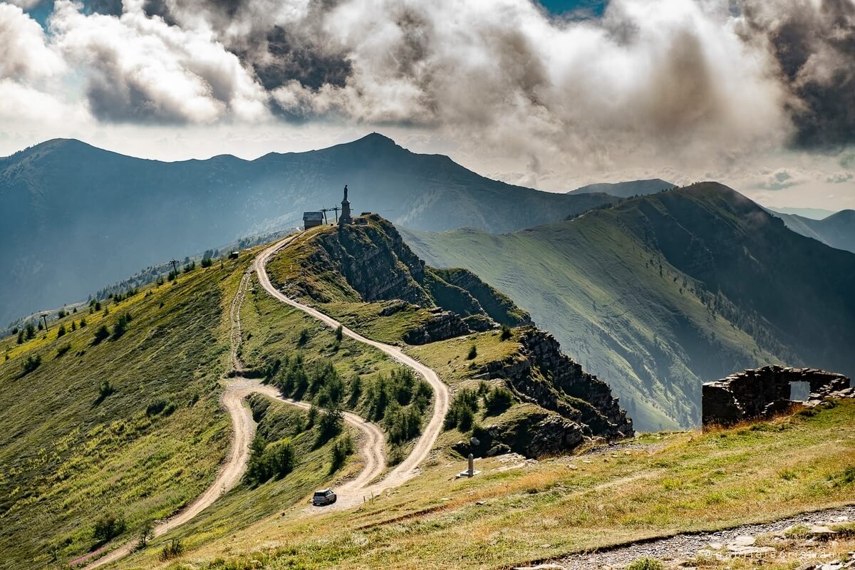
Located on the border between France and Piedmont, in the inland of Ventimiglia and Sanremo area, Ligurian Alps Natural Regional Park (Parco Naturale Regionale delle Alpi Liguri) was established in 2007 and covers a protected area of over 60 square kilometres. It protects some of the most beautiful and important areas of the Ligurian Alps and includes four separate areas: Zona di Pian Cavallo, which is located in the North of the park along the border with Piemonte and includes a well known conifers and beech forest named the Bosco delle Navette and some natural caves; Dorsale Monte del Monte Saccarello - Monte Frontè - Monte Monega, the highest part of the park with wide grazing areas; Comprensorio del Monte Gerbonte - M. more
Toraggio/Pietravecchia, which hosts the 600 ha Foresta Demaniale of Gerbonte; and Foresta Demaniale di Testa d'Alpe, which is the southernmost part of the park, just some 15 km from the Ligurian Sea.
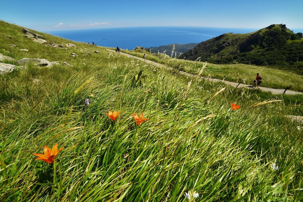
The park offers amazing landscapes including the highest mountain in Ligurian territory (Mount Saccarello 2,200 m), the deepest cave (Melosa), impressive views from the Alta Via dei Monti Liguri (the High Road of the Ligurian Mountains) and many other areas of great environmental interest. The natural park is shared by the following municipalities: Cosio di Arroscia, Mendatica, Pigna, Montegrosso Pian Latte, Rezzo, Rocchetta Nervina and Triora and offers a wide range of footpaths from south-west to east by the Alta Via dei Monti Liguri (35 km), a long-distance trail from Ventimiglia (province of Imperia) to Bolano (province of La Spezia).
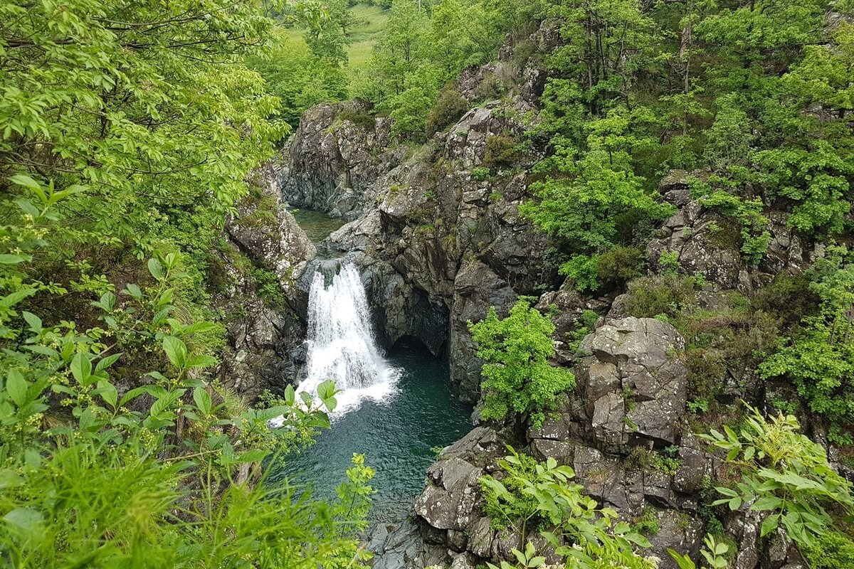
Other itineraries connected with paths such as “Alpi del Mare in bici” (Sea Alps by bike) have been recommended for mountain bikers, and others are used by associations and guides with snowshoes and trekking on horseback. It is also possible to follow the thematic itinerary of “Memoria delle Alpi” (Memory of the Alps), "A caccia di fioriture" (Discovering Flowers) and "Ecomuseo della Biodiversità" (Ecomuseum of Biodiversity). Some important attractions of the Ligurian Alps Natural Regional Park are the Cascate dell’Arroscia (Arroscia Waterfalls), hydrothermal springs (Pigna), Loreto and Realdo cliffs (Triora) and tens of caves of great dimensions.
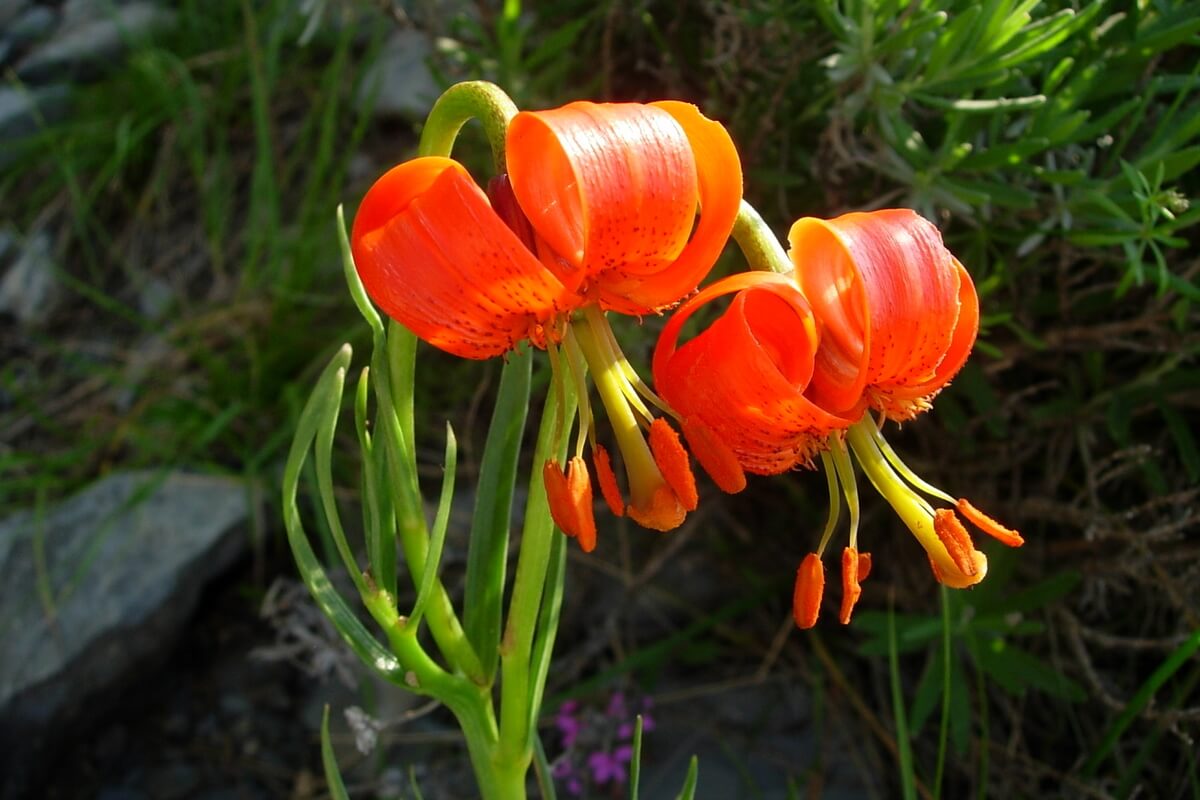
The geographical position, the differences in substrate and the climate are the main factors that make this area one of the richest from a floristic point of view. It is considered one of the “botanical paradises” of the European continent and has almost 3,000 plant species, an enormous concentration (about 50% of the entire national flora) when compared to the size of the region.
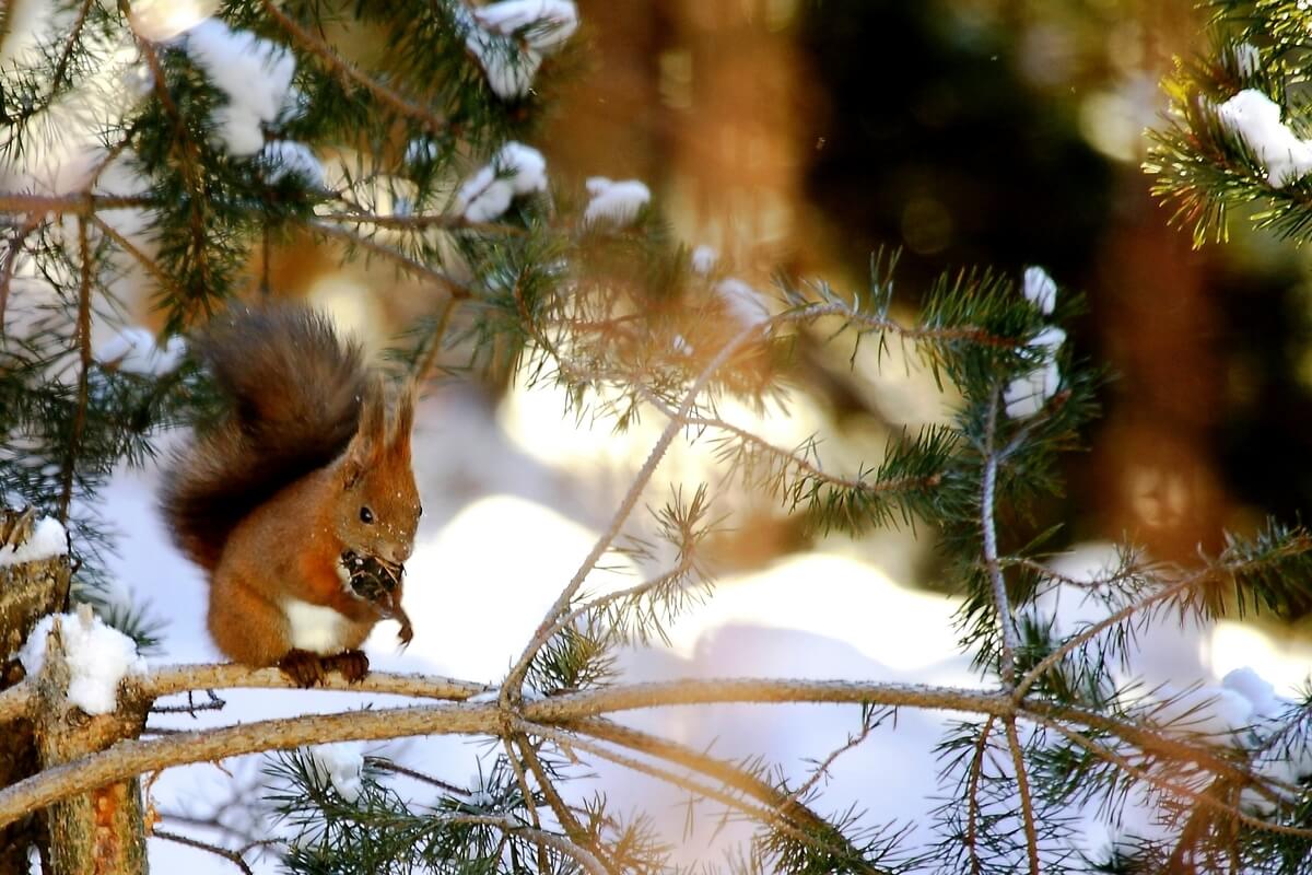
The mountains and valleys of the park are home to a wide wildlife variety including rare mammals such as stoats (Mustela erminea), mountain hares (Lepus timidus), European pine martens (Martes martes), European snow voles (Microtus nivalis), as well as wolves (coming from Roya valley) and wildcats (Felis silvestris). Among birds can be distinguished the black woodpecker (Dryocopus martius), the Eurasian eagle-owl (Bubo bubo), which is the biggest European bird of prey, the black grouse (Tetrao tetrix), and the eagle (Aquila chrysaetos). The caves situated in the park host a wide variety of bats and insects.
The park offers amazing landscapes including the highest mountain in Ligurian territory (Mount Saccarello 2,200 m), the deepest cave (Melosa), impressive views from the Alta Via dei Monti Liguri (the High Road of the Ligurian Mountains) and many other areas of great environmental interest. The natural park is shared by the following municipalities: Cosio di Arroscia, Mendatica, Pigna, Montegrosso Pian Latte, Rezzo, Rocchetta Nervina and Triora and offers a wide range of footpaths from south-west to east by the Alta Via dei Monti Liguri (35 km), a long-distance trail from Ventimiglia (province of Imperia) to Bolano (province of La Spezia).
Other itineraries connected with paths such as “Alpi del Mare in bici” (Sea Alps by bike) have been recommended for mountain bikers, and others are used by associations and guides with snowshoes and trekking on horseback. It is also possible to follow the thematic itinerary of “Memoria delle Alpi” (Memory of the Alps), "A caccia di fioriture" (Discovering Flowers) and "Ecomuseo della Biodiversità" (Ecomuseum of Biodiversity). Some important attractions of the Ligurian Alps Natural Regional Park are the Cascate dell’Arroscia (Arroscia Waterfalls), hydrothermal springs (Pigna), Loreto and Realdo cliffs (Triora) and tens of caves of great dimensions.
The geographical position, the differences in substrate and the climate are the main factors that make this area one of the richest from a floristic point of view. It is considered one of the “botanical paradises” of the European continent and has almost 3,000 plant species, an enormous concentration (about 50% of the entire national flora) when compared to the size of the region.
The mountains and valleys of the park are home to a wide wildlife variety including rare mammals such as stoats (Mustela erminea), mountain hares (Lepus timidus), European pine martens (Martes martes), European snow voles (Microtus nivalis), as well as wolves (coming from Roya valley) and wildcats (Felis silvestris). Among birds can be distinguished the black woodpecker (Dryocopus martius), the Eurasian eagle-owl (Bubo bubo), which is the biggest European bird of prey, the black grouse (Tetrao tetrix), and the eagle (Aquila chrysaetos). The caves situated in the park host a wide variety of bats and insects.
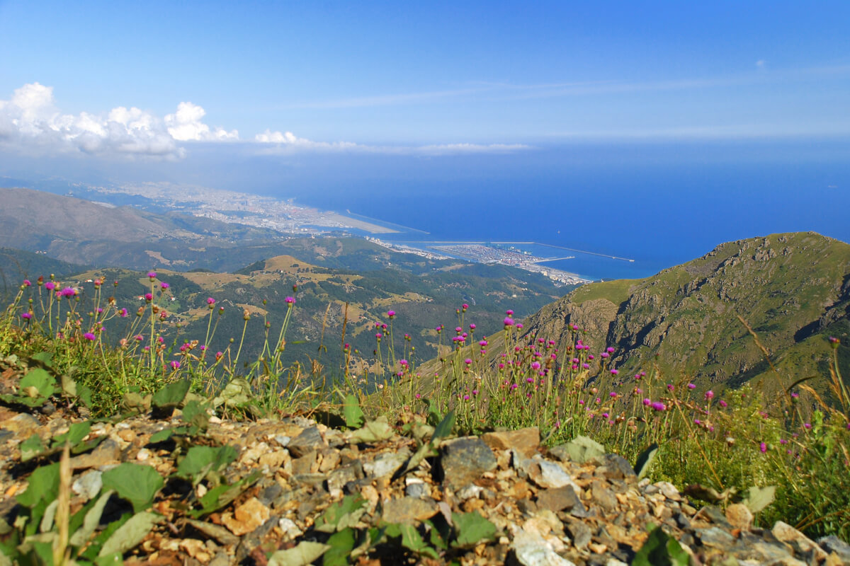
Beigua Natural Regional Park (Parco Naturale Regionale del Beigua) is located in the inland of the Italian Riviera between Savona and Genoa and covers a protected area of 87.23 km2 (8,723 ha) including 26 km of the Apenninic watershed dividing Pianura Padana (tributary of the Adriatic Sea) from the Ligurian Sea drainage basin. Established in 1985, the park represents the largest protected area of Liguria region and gets its name from the highest mountain of the area, Mount Beigua (1,287 m). In 2005, Beigua Geopark was recognized as a part of the European Geoparks Network and the UNESCO Global Network of Geoparks. The geopark is larger than the Natural Regional Park and covers an area of 39,230 ha.
The area of the natural park is divided among 10 municipalities: Arenzano, Campo Ligure, more
The area of the natural park is divided among 10 municipalities: Arenzano, Campo Ligure, more
Genova, Cogoleto, Masone, Rossiglione, Sassello, Stella, Tiglieto, Varazze and offers a wide range of geological features, the majority of which are tied to a portion of Jurassic oceanic crust modified during the Alpine orogeny. The predominant rocks of the area include gabbros, peridotites and serpentinites.
Besides Mount Beigua, other summits located in the park are Mount Reixa (1,183 m), Cima Fontanaccia (1,153 m), Mount Rama (1,150 m), Mount Beigua Bric del Dente (1,107 m) and Mount Sciguello (1,103 m). There are about 500 km of footpaths available within the park, which is crossed from west to east by the Alta Via dei Monti Liguri, a long-distance trail from Ventimiglia (province of Imperia) to Bolano (province of La Spezia).
The flora of the park includes some rare plants such as Bertoloni's pansy (Viola bertolonii), Cerastium utriense, Asplenium cuneifolium, Rose daphne (Daphne cneorum) and Cheilantes marantae. The fauna is characterized by common large animals such as wild boars, roe and fallow deers and includes some locally endangered species of amphibians such as alpine newt, northern crested newt and Malpolon monspessulanus living in mountain mires and wetlands. This area is peculiar due to the arrival of thousands of migratory birds in spring and autumn representing a real charming spectacle. You will have the chance to watch day birds of prey (such as the Honey Buzzard, the Short-toed Eagle, the Black Kite or the Marsh Harrier) and storks, birds tha are numerous and have the region of Liguria as a second home.
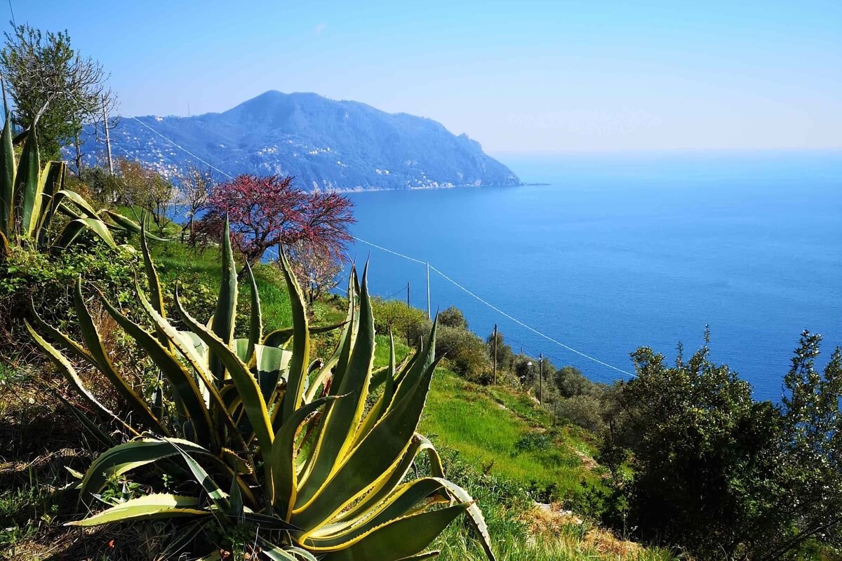
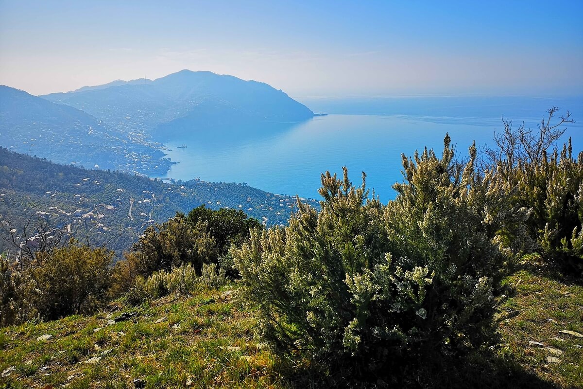
Portofino Natural Regional Park (Parco Naturale Regionale di Portofino) is a protected natural area located on the Riviera di Levante, 30 km east of Genoa, and includes the municipalities of Camogli, Portofino and Santa Margherita Ligure. This little part of the Ligurian land was protected together with the Marine Protected Area of Portofino preserving a wide range of marine community of the high Tyrrhenian Sea.
The park was founded in 1935 and has a land area of 18 km² and a coastal strip of 13 km². It is the northernmost coastal protected area in the Mediterranean Sea with a typically Mediterranean vegetation made up of chestnut groves, hazel groves, olive groves, pine forests, oak groves and many beautiful flowers. The exceptional variety of habitats and microclimate contributed to one of the largest flower concentrations in the Mediterranean area. more
The park was founded in 1935 and has a land area of 18 km² and a coastal strip of 13 km². It is the northernmost coastal protected area in the Mediterranean Sea with a typically Mediterranean vegetation made up of chestnut groves, hazel groves, olive groves, pine forests, oak groves and many beautiful flowers. The exceptional variety of habitats and microclimate contributed to one of the largest flower concentrations in the Mediterranean area. more
More than 700 spontaneous species live in a limited area with small altitude variations (0-610 m) including the rare Spoon-leaved saxifrage (Saxifraga cochlearis). Ferns (rock and wall ferns, royal ferns, and the Cretan brakes) are particularly interesting. The Park Authority maintains more than 80 km of itineraries, some of which can only be used accompanied by guides.
The fauna of the park includes a huge variety of birds (about one hundred species) and invertebrates (more than 20 Ligurian endemic species). The avifauna includes maquis birds such as the Sardinian Warbler, Dartford Warbler, Blackcap, and Whitethroat; clearing birds such as the Hoopoe, Ortolan Bunting, and Goldfinch; wood birds such as the Thrush, Blue tit, Chaffinch, Robin, and Jay; pinewood birds such as the Turtle dove and Woodpigeon; birds of prey such as the Kestrel, Buzzard, Peregrine, and Hobby; and sea birds such as Seagulls, Common terns, Shearwaters and Gannets. There are also amphibians including the Mediterranean Treefrog, the Cave Salamander, and the Italian Frog and reptiles such as the Turkish Gecko, the Moorish Gecko, and the Green Lizard. The mammals include foxes, badgers, squirrels, stone martens, hedgehogs, wild boars, and several micromammals. Among invertebrates, the Two-tailed Pasha (Caraxes jasius) should be mentioned, since it is becoming very rare in Liguria.
The rocky spur of the Promontory stretching towards the open sea, gives origin to one of the most interesting and intact seabeds of the Mediterranean basin. The whole spectrum of biocenosis of the Upper Tyrrhenian Sea is represented in this stretch of seabed. Particularly relevant is the vegetal and animal richness of the coast including Porifera and Posidonia beds, the formations of yellow gorgonian (Eunicella stricta), orange gorgonian (Eunicella cavolinii), red gorgonian (Paramuricea chamaelon), and the populations of coral (Corallium rubrum). A Marine Reserve has been established to protect the wonderful seabed.
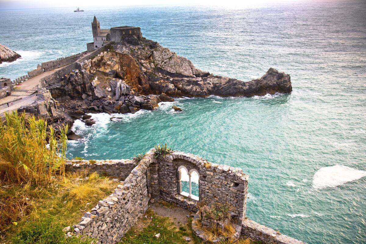
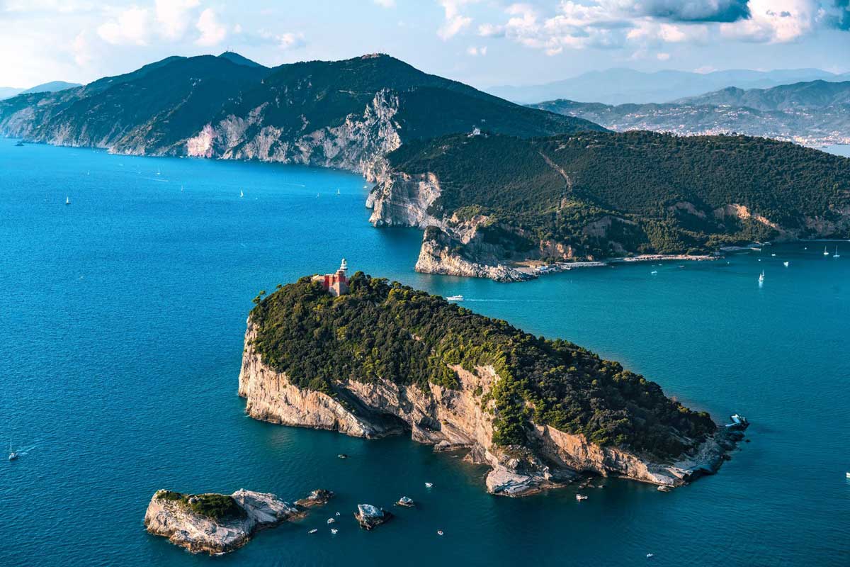
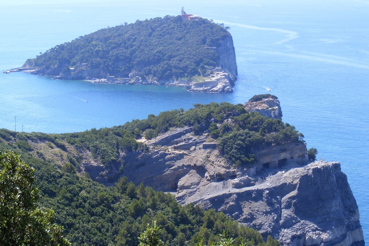
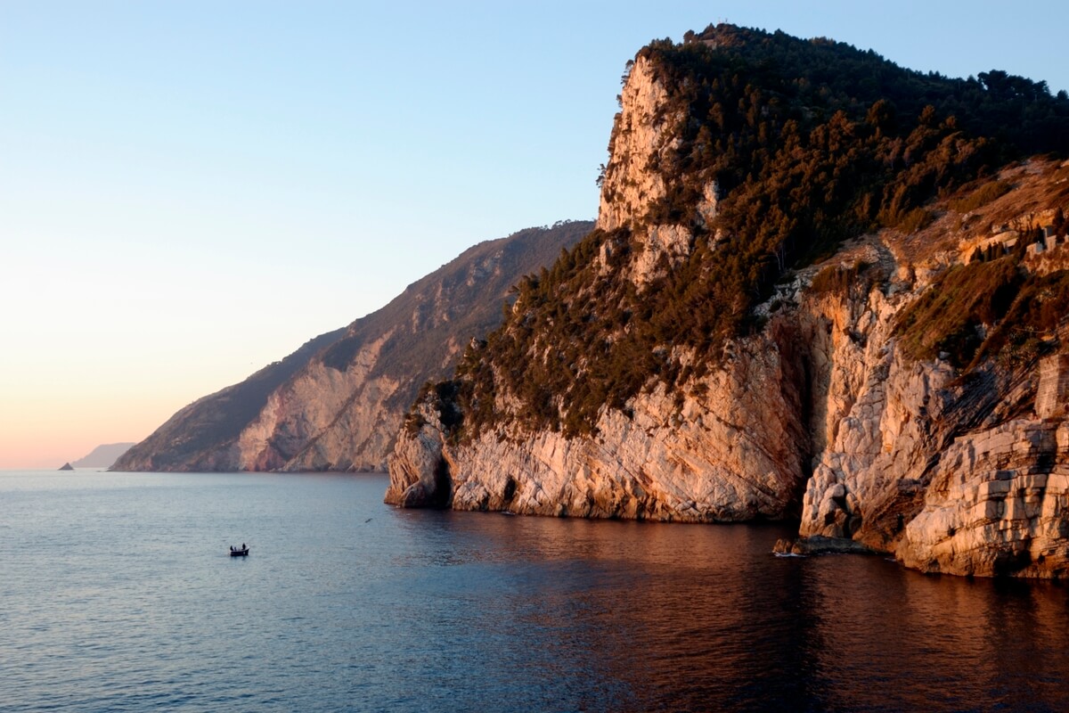
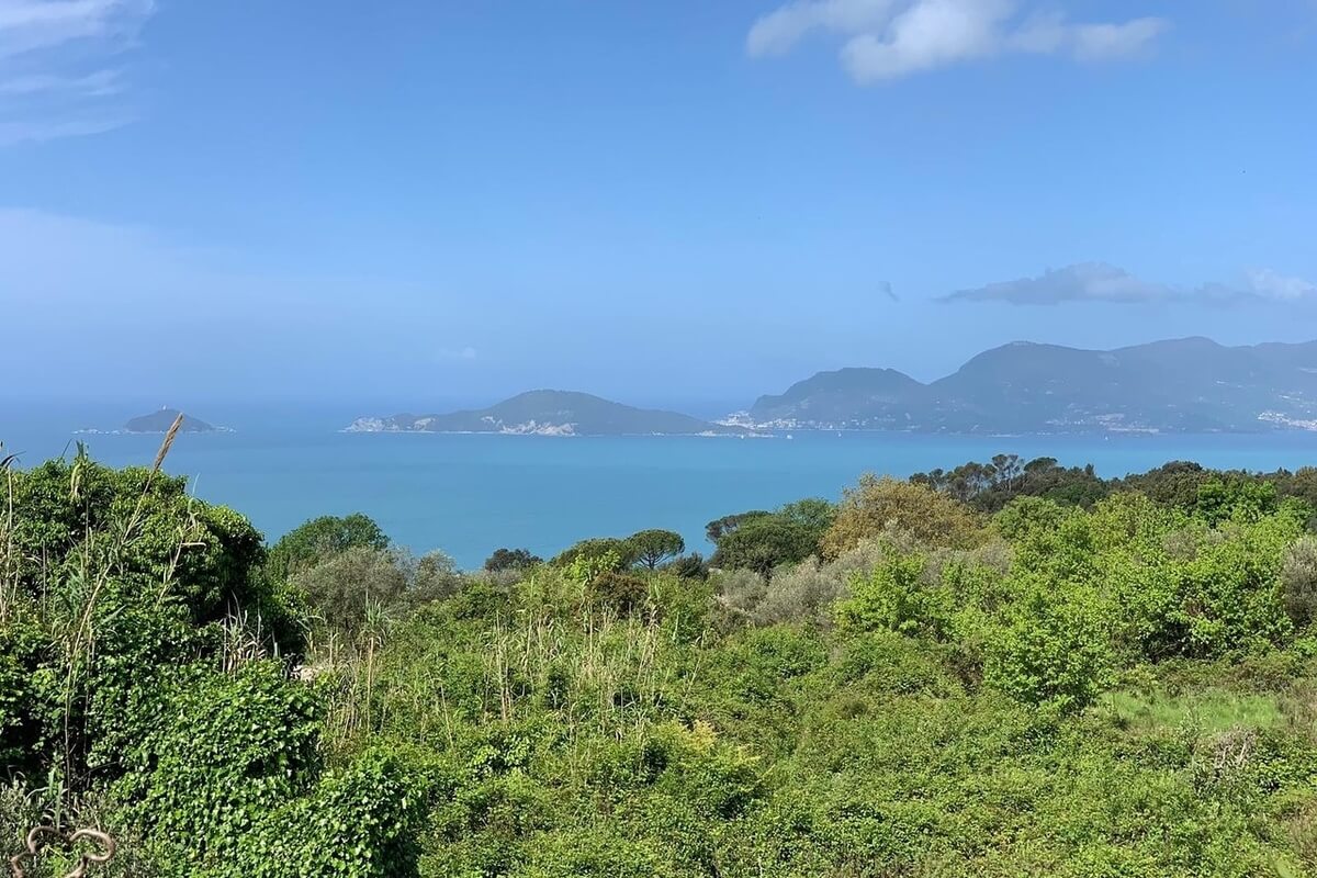
Located in the area around La Spezia, Porto Venere Natural Regional Park is about 400 hectares large, and covers the most important area of the eastern section of Liguria including the promontory of Porto Venere, the islands of Palmaria, Tino and Tinetto, and the protected marine area. The whole area was declared in 1997 a UNESCO World Heritage by the establishment of the site “Porto Venere Cinque Terre e Isole”, demonstrating the importance of the biodiversity of the Protected Area.
This area is characterized by a luxuriant and variegated Mediterranean scrub including several species of plants such as the garigue, Giant Orchids, Oaks, Aleppo Pines, and most of all the famous Porto Venere’s cornflower, a small endemic plant present in the promontory and the islands. The Marine Protected Area including Porto Venere channel is characterized by a Posidonia seabed on the southwestern coast of the island, more
This area is characterized by a luxuriant and variegated Mediterranean scrub including several species of plants such as the garigue, Giant Orchids, Oaks, Aleppo Pines, and most of all the famous Porto Venere’s cornflower, a small endemic plant present in the promontory and the islands. The Marine Protected Area including Porto Venere channel is characterized by a Posidonia seabed on the southwestern coast of the island, more
and the stretch of sea surrounding Tino and Tinetto islands.
The fauna includes many species of birds including the Common Raven (Corvus corax), the Peregrine (Falco peregrinus), the Blue Rock Thrush (Monticola solitarius), and the Alpine Swift (Apus Melba). The area is also inhabited by a peculiar animal - the smallest European gecko (8 cm long, tail included), which is a night reptile present exclusively in Torre Quezzi, in the province of Genoa, and on Tino and Tinetto islands. The small Posidonia seabed (Posidonia Oceanica) of the channel offers shelter and food to a great number of marine organisms and fish such as the Wrasse (Labrus viridis), the Great Pipefish (Syngnathus acus), the Sea Horse (Hippocampus ramulosus) and the Annular Seabream (Diplodus annularis).
The fauna includes many species of birds including the Common Raven (Corvus corax), the Peregrine (Falco peregrinus), the Blue Rock Thrush (Monticola solitarius), and the Alpine Swift (Apus Melba). The area is also inhabited by a peculiar animal - the smallest European gecko (8 cm long, tail included), which is a night reptile present exclusively in Torre Quezzi, in the province of Genoa, and on Tino and Tinetto islands. The small Posidonia seabed (Posidonia Oceanica) of the channel offers shelter and food to a great number of marine organisms and fish such as the Wrasse (Labrus viridis), the Great Pipefish (Syngnathus acus), the Sea Horse (Hippocampus ramulosus) and the Annular Seabream (Diplodus annularis).
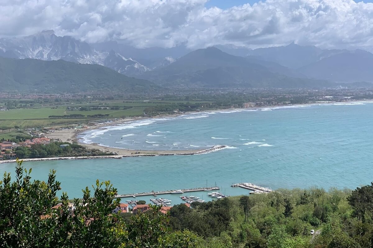
Located at the borderline between the regions of Tuscany and Liguria, Montemarcello Magra Vara Natural Regional Park (Parco Naturale Regionale di Montemarcello-Magra-Vara) covers an area of 4,320 hectares including the following municipalities: Ameglia, Arcola, Bolano, Beverino, Borghetto di Vara, Brugnato, Calice al Cornoviglio, Carrodano, Carro, Follo, Lerici, Rocchetta di Vara, Santo Stefano di Magra, Sesta Godano Sarzana and Vezzano Ligure. The park offers many different kinds of landscapes: the sea and the coast with its sandy beaches, the rolling hills of the Vara Valley and the Magra Valley rich of flora and fauna biodiversity. The Romans once founded here the settlement of Luni.
Surrounded by Mediterranean vegetation, the peak of Caprione promontory offers a breathtaking view over La Spezia Gulf in the west and over the fertile plain of the Magra River in the east. more
Surrounded by Mediterranean vegetation, the peak of Caprione promontory offers a breathtaking view over La Spezia Gulf in the west and over the fertile plain of the Magra River in the east. more
The river area is characterized by cultivated lands and wetlands where aquatic birds nest, and by endangered areas. The most intact river stretch is represented by the Vara River, a tributary of the Magra River.
The hills area, made up of the Promontory of Caprione, represents a spectacular place of natural and cultural importance, from where it is possible to start many excursions. It goes from Arcola town until Punta Bianca, located on the sea. The valley is rich in historical towns and castles, as well as in ancient and picturesque water mills.
The flora of the park is made up of river vegetation including willows and alders located on the river banks, together with the euphorbia, the Hawthorn, the Geranium nodosum, and other species typical of a fresh climate and hill vegetation including the holm oak or the myrtle and some special species such as the grey-leaved cistus (Cistus albidus).
The fauna includes species such as the grey heron, the purple heron, the mallard, the little grebe, the little egret, the gadwall, etc. living in the humid area of the Magra River, as well as mammals such as the hedgehog, the squirrel, the dormouse, the weasel, the badger and the boar living in the area of Montemarcello. Additionally, you can see many birds, such as blackcaps, goldfinches, robins, thrushes, chaffinches, eagle owls, gulls and many more.
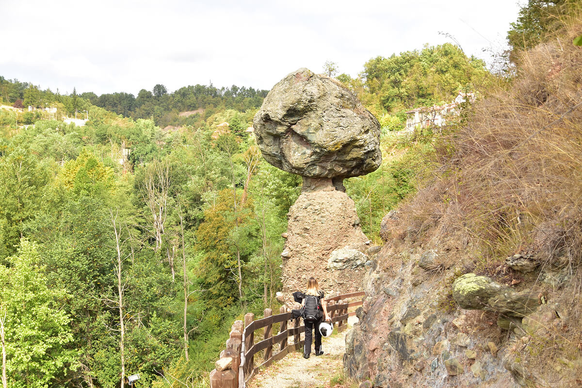

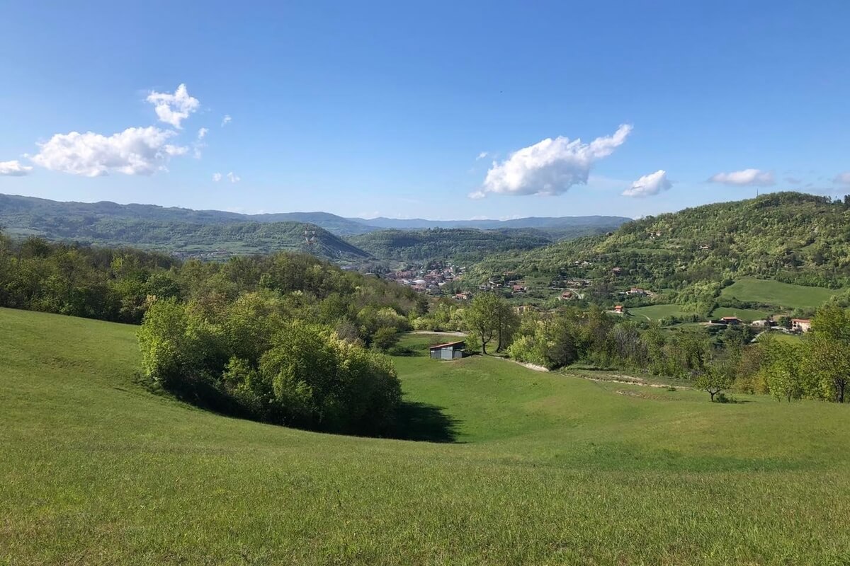
Located within the territory of the town of Piana Crixia in the province of Savona, Piana Crixia Natural Regional Park (Parco Naturale Regionale di Piana Crixia) was established in 1989 and covers an area of 794.71 hectares bordering the provinces of Cuneo, Asti and Alessandria in the Piedmont region.
The landscape is characterized by the contrast between the valleys created by the Bormida di Spigno River and the harsh mountains. Near the country hamlet Borgo, on the bank of a meander of the Bormida di Spigno, you can see a fifteen-metre high “stone mushroom”, the most peculiar geological phenomenon of the territory and of the area of Liguria and Piedmont. more
The territory of Piana Crixia was inhabited since ancient times and important Roman and medieval ways of communication passed through it. The hills mainly remained uninhabited until the best grounds of the bottom of the valley were all cultivated. Currently the gentle cultivated hills alternate with harsh mountains, but the farmers always struggled with the impeding gully areas. However, the contrast between the grey colour of the gullies and the colours of the surrounding fields and woods gives birth to a suggestive picture which is unique in Liguria.
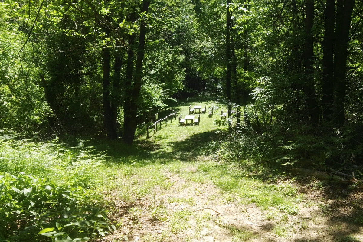
Bric Tana Natural Regional Park (Parco Naturale Regionale di Bric Tana) covers an area of 169.50 hectares in the Province of Savona and encompasses the protected area of Bric Tana and Valle dei Tre Re with the purpose to safeguard an environment or natural phenomenon of particular importance. This area is interesting due to its unique karstic phenomena in the Province of Savona, characteristic not only for the development of underground cavities, but also for the specific geological soils in which they appear. The existence of a big fissure or cave called “Tana” (meaning "den"), makes the research activity even more interesting.
Between the two sections of the protected area, on the right and left banks of the Bormida di Spigno River, the Dolomie di San Pietro dei Monti outcrop, more
Between the two sections of the protected area, on the right and left banks of the Bormida di Spigno River, the Dolomie di San Pietro dei Monti outcrop, more
consisting of grey dolomitic sandstones that in other places can also house karstic networks.
The area is populated by a few animal species including 10 species of bats, but it is difficult to sight them, also because of the twilight and/or night habits characterizing most of the species. After long periods of study and observation, it has been possible to draw up a list including about forty different species.
The area is populated by a few animal species including 10 species of bats, but it is difficult to sight them, also because of the twilight and/or night habits characterizing most of the species. After long periods of study and observation, it has been possible to draw up a list including about forty different species.