Ise Shima National Park occupies a vast area of 55,544 ha expanding over the cities of Ise, Toba, Shima, and Minami-Ise and encompasses the Shima Peninsula, a coastal resort area in central Japan known for its rugged shore and pearl cultivation in Ise-Shima’s Ago Bay. The peninsula is home to Ise Shrines, the most important and sacred Shinto shrines and is a popular leisure resort area among the urban population of Nagoya and Osaka.
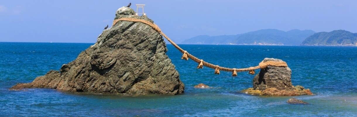
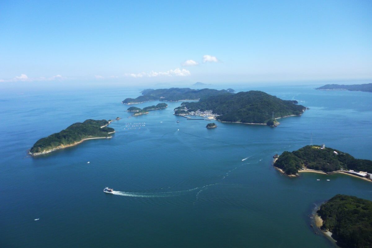
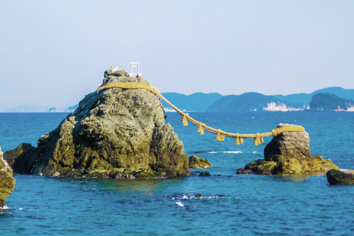
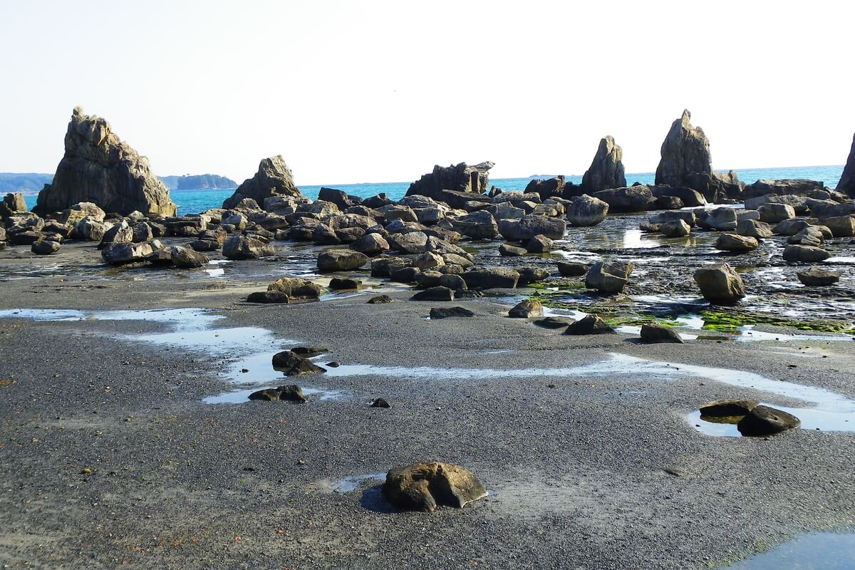
Ise Shima National Park can be divided into two areas. One is the inland area where Ise Jingu (Ise Grand Shrine) is situated being surrounded by a forest environment. The other is the coastal area that has a complex landform of a ria coastline abounding in capes and inlets (around 60 small and large islands), which were created by seawater entering the areas that were previously rivers and valleys. more
Ise Shima National Park can be divided into two areas. One is the inland area where Ise Jingu (Ise Grand Shrine) is situated being surrounded by a forest environment. The other is the coastal area that has a complex landform of a ria coastline abounding in capes and inlets (around 60 small and large islands), which were created by seawater entering the areas that were previously rivers and valleys. more
Moreover, Kamishima Island has a karst landscape which is a unique landform created by the erosion of limestone by rainwater and groundwater.
Due to the fact that the park has an extremely high proportion of private land (over 96%), the biggest feature of this park is to be able to come in close contact with local people’s livelihoods, history, culture and customs, so that the visitors could be able to appreciate the beautiful landscapes, as well as the relationship between people and nature.
Today, the flora found in the mountains is mostly a second-growth forest consisting of dwarf trees of Quercus phillyraeoides, Ilex pedunculosa, Pinus densiflora, etc. The coastal flora is represented by plants that grow in a harsh environment where the sea breeze constantly moves sand around. In the sandbars situated adjacent to the mouth of the Iseji River in Gokasho Bay, scrub forests of Hibiscus hamabo grow allowing visitors to enjoy in summer a splendid view filled with beautiful tropical flowers.
The sandy beaches across the park became egg-laying sites for loggerhead turtles, while the rocky shores, cliffs, and rock ledges are a habitat for rare birds such as osprey, Japanese cormorant, blue rock thrush, streaked shearwater, Pacific reef heron, etc.
Yoshino Kumano National Park was established as a national park in 1936 and covers the southern coastal areas and the Kii Mountain Range of the Kii Peninsula reaching 61,406 ha (land area). A part of the park area named the “Sacred Sites and Pilgrimage Routes in the Kii Mountain Range” was designated as a UNESCO World Heritage Site, while another part of the northern area was designated as a UNESCO Eco Park aimed at ensuring sustainable use. Nanki Kumano area of the park was registered as a Japanese Geopark.
Yoshino Kumano National Park is a park of varied landscapes consisting of mountains, rivers, valleys and beaches. It includes the Omine Mountain Range, consisting of mountains rising 1,500 m to 1,900 m above sea level, Osugi Valley, Odaigahara Plateau, the Higashinokawa River, the Kumano River, more
Yoshino Kumano National Park is a park of varied landscapes consisting of mountains, rivers, valleys and beaches. It includes the Omine Mountain Range, consisting of mountains rising 1,500 m to 1,900 m above sea level, Osugi Valley, Odaigahara Plateau, the Higashinokawa River, the Kumano River, more
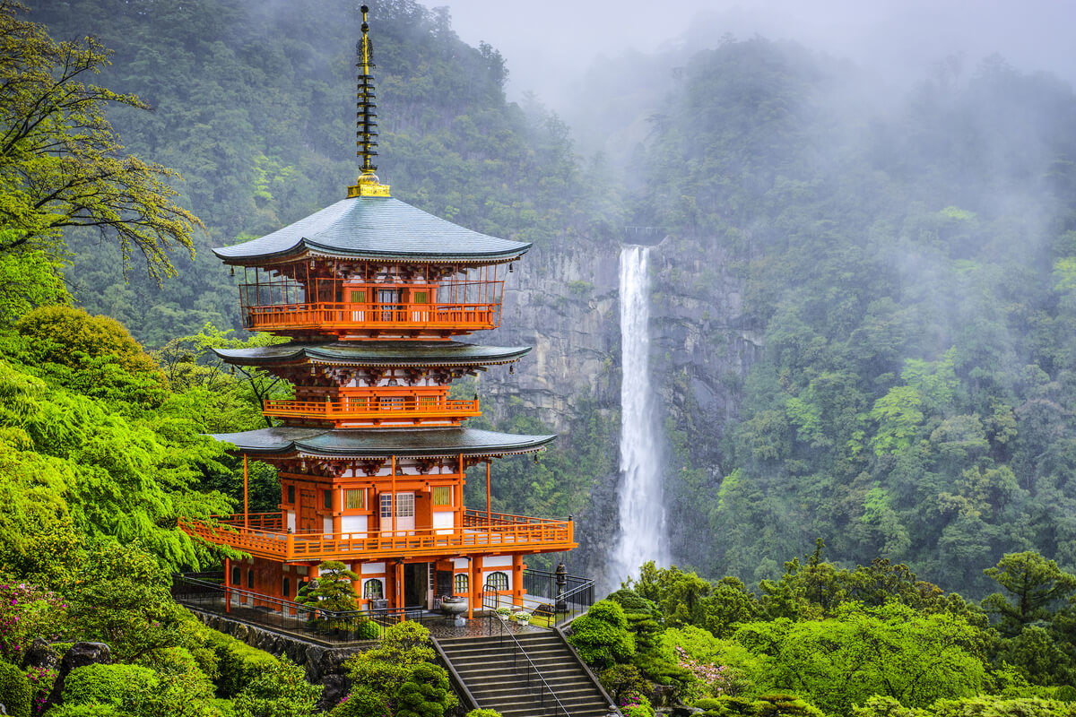
the Kitayama River, etc. The park includes Mt. Yoshino, one of Japan’s most famous cherry blossom spots and Mt. Nachi Area with the famous Nachi Falls, the tallest waterfall in Japan with single uninterrupted drop with a height of 133 m. The tallest waterfalls with multiple drops in Japan are the Hannoki Falls, at 497 m (seasonal), and the Shomyo Falls, at 350 m (all year round).
The park is a religious sacred place for the Omine Shugen and the Kumano worship that flourished from the medieval era to the early modern era having many old shrines and temples that pass down old traditions throughout Mt. Yoshino, Dorogawa, Mt. Sanjogatake and Zenki and Mt. Nachi.
The park is a religious sacred place for the Omine Shugen and the Kumano worship that flourished from the medieval era to the early modern era having many old shrines and temples that pass down old traditions throughout Mt. Yoshino, Dorogawa, Mt. Sanjogatake and Zenki and Mt. Nachi.